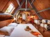


Favourite
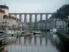
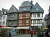
Morlaix
| Municipality | Plougras |
|---|---|
| Postcode | 22780 |
| Latitude | 48.5105980 (N 48° 30’ 38”) |
| Longitude | -3.5617070 (W 3° 33’ 42”) |
| Altitude | From 164m to 314m |
| Surface area | 26.48 km² |
| Population | 424 inhabitants |
| Density | 16 inhabitants/km² |
| Prefecture | Saint-Brieuc (71 km, 55 min) |
| Insee code | 22217 |
| Intercommunality | CA Lannion-Trégor Communauté |
| Department | Côtes-d'Armor |
| Region | Brittany |
| Guerlesquin | 2.5 km (4 min) |
|---|---|
| Loguivy-Plougras | 6.9 km (10 min) |
| Lohuec | 7.8 km (11 min) |
| Bolazec | 9.2 km (17 min) |
| Botsorhel | 9.4 km (14 min) |
| Plouégat-Moysan | 9.6 km (12 min) |
| Calanhel | 12.5 km (18 min) |
| Trémel | 12.7 km (13 min) |
| Plounévez-Moëdec | 13 km (20 min) |
| Lannéanou | 13.2 km (16 min) |
| Plounérin | 13.9 km (17 min) |
| Scrignac | 15 km (17 min) |
| Loc-Envel | 16.2 km (24 min) |
| Last name | Outing type | Difficulty | Duration | Departure municipality |
|---|---|---|---|---|
 | Hike | Easy | 55 min | Plougras |
 | Hike | Intermediate | 2:35 | Loguivy-Plougras (6.3 km) |
 | Hike | Easy | 20 min | Loguivy-Plougras (6.3 km) |
 | Hike | Easy | 2:15 | Plounérin (6.4 km) |
 | Hike | Intermediate | 3:05 | Bolazec (7.6 km) |