


Favourite
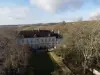
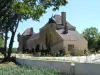
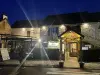
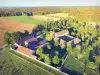
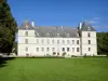
Vausse Priory
| Municipality | Aisy-sur-Armançon |
|---|---|
| Postcode | 89390 |
| Latitude | 47.6683660 (N 47° 40’ 6”) |
| Longitude | 4.2251810 (E 4° 13’ 31”) |
| Altitude | From 192m to 346m |
| Surface area | 17.97 km² |
| Population | 248 inhabitants |
| Density | 13 inhabitants/km² |
| Prefecture | Auxerre (59 km, 56 min) |
| Insee code | 89004 |
| Intercommunality | CC Le Tonnerrois en Bourgogne |
| Department | Yonne |
| Territory | Burgundy |
| Region | Burgundy-Franche-Comté |
| Rougemont | 2.7 km (4 min) |
|---|---|
| Perrigny-sur-Armançon | 3.5 km (5 min) |
| Buffon | 5.7 km (6 min) |
| Cry | 6.2 km (7 min) |
| Nuits | 7.6 km (6 min) |
| Étivey | 7.8 km (9 min) |
| Saint-Rémy | 7.8 km (8 min) |
| Ravières | 9.1 km (10 min) |
| Asnières-en-Montagne | 9.9 km (13 min) |
| Bierry-les-Belles-Fontaines | 10.7 km (13 min) |
| Fulvy | 11.6 km (11 min) |
| Montbard | 12.4 km (15 min) |
| Crépand | 12.5 km (13 min) |
| Fain-lès-Moutiers | 12.7 km (17 min) |
| Natural sites |
|---|
| Last name | Activity type | Rate | City |
|---|---|---|---|
 | Entertainment | 8 € | Chamoux (48 km) |
| Last name | Outing type | Difficulty | Duration | Departure municipality |
|---|---|---|---|---|
 | Hike | Intermediate | 5:20 | Étourvy (33 km) |
 | Hike | Intermediate | 3:20 | Thenissey (35 km) |
 | Hike | Easy | 2:00 | Courgis (37 km) |
 | All-terrain bike itinerary | Athletic | 5:40 | Mussy-sur-Seine (40 km) |
 | Hike | Easy | 2:15 | Saint-Agnan (40 km) |