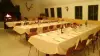


Favourite
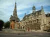
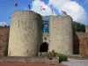
Noyon
| Municipality | Andechy |
|---|---|
| Postcode | 80700 |
| Latitude | 49.7141320 (N 49° 42’ 51”) |
| Longitude | 2.7097150 (E 2° 42’ 35”) |
| Altitude | From 58m to 104m |
| Surface area | 7.77 km² |
| Population | 287 inhabitants |
| Density | 36 inhabitants/km² |
| Prefecture | Amiens (39 km, 46 min) |
| Insee code | 80023 |
| Intercommunality | CC du Grand Roye |
| Department | Somme |
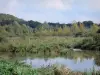
| Territory | Picardy |
| Region | Hauts-de-France |
| Villers-lès-Roye | 2.2 km (4 min) |
|---|---|
| Damery | 3.4 km (6 min) |
| Erches | 3.6 km (6 min) |
| L'Échelle-Saint-Aurin | 3.9 km (6 min) |
| Guerbigny | 4.7 km (6 min) |
| Warsy | 5.4 km (8 min) |
| Goyencourt | 6 km (10 min) |
| Armancourt | 6.1 km (12 min) |
| Saint-Mard | 6.1 km (8 min) |
| Fresnoy-lès-Roye | 6.1 km (10 min) |
| Parvillers-le-Quesnoy | 6.9 km (11 min) |
| Roye | 7 km (11 min) |
| Bouchoir | 7.1 km (10 min) |
| Lignières | 7.2 km (9 min) |
| Last name | Activity type | Rate | City |
|---|---|---|---|
 | Culture and education | 10 € to 450 € | Lassigny (17 km) |
 | Culture and education | 7 € | Compiègne (34 km) |
| Last name | Outing type | Difficulty | Duration | Departure municipality |
|---|---|---|---|---|
 | Hike | Easy | 2:00 | Paillart (27 km) |
 | Cycling itinerary | Easy | 3:00 | Blangy-Tronville (28 km) |
 | Village visit | Easy | 1:00 | Blangy-Tronville (28 km) |
| Hike | Easy | 3:00 | Dernancourt (29 km) |
 | Village visit | Easy | 1:00 | Clairoix (32 km) |