

Favourite
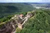
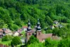
Saint-Quirin
| Municipality | Angomont |
|---|---|
| Postcode | 54540 |
| Latitude | 48.5160250 (N 48° 30’ 58”) |
| Longitude | 6.9471010 (E 6° 56’ 50”) |
| Altitude | From 338m to 660m |
| Surface area | 17.28 km² |
| Population | 76 inhabitants |
| Density | 4 inhabitants/km² |
| Prefecture | Nancy (73 km, 1:02) |
| Insee code | 54017 |
| Intercommunality | CC de Vezouze en Piémont |
| Department | Meurthe-et-Moselle |
| Territory | Lorraine |
| Region | Great East |
| Bréménil | 3 km (5 min) |
|---|---|
| Saint-Sauveur | 3.4 km (6 min) |
| Parux | 5.2 km (8 min) |
| Badonviller | 6.9 km (10 min) |
| Val-et-Châtillon | 7.5 km (12 min) |
| Montreux | 7.6 km (14 min) |
| Petitmont | 8.2 km (11 min) |
| Nonhigny | 8.2 km (16 min) |
| Fenneviller | 8.3 km (13 min) |
| Neuviller-lès-Badonviller | 8.5 km (13 min) |
| Pexonne | 9.5 km (14 min) |
| Harbouey | 10.1 km (19 min) |
| Halloville | 10.2 km (19 min) |
| Cirey-sur-Vezouze | 10.4 km (17 min) |
| Last name | Activity type | Rate | City |
|---|---|---|---|
 | Arts and Crafts | Free | Ranrupt (24 km) |
 | Culture and education | 12 € | Laveline-devant-Bruyères (40 km) |
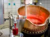
 | Local flavours | Free | Rodern (44 km) |
 | Local flavours | Free | Ribeauvillé (47 km) |
 | Entertainment | Free | Xonrupt-Longemer (48 km) |
| Last name | Outing type | Difficulty | Duration | Departure municipality |
|---|---|---|---|---|
 | Hike | Intermediate | 5:25 | Saint-Quirin (13.6 km) |
 | Hike | Intermediate | 3:15 | Rothau (20 km) |
 | Hike | Easy | 3:55 | Walscheid (21 km) |
 | Hike | Intermediate | 3:35 | Walscheid (21 km) |
 | Mountain bike itinerary | Intermediate | 2:10 | Walscheid (21 km) |