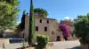
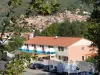
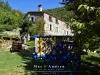
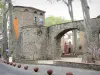
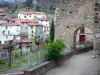
Roman city at the heart of Vallespir at the confluence of the Tech and Riuferrer, Arles-sur-Tech invites you to discover its sunny squares, its medieval streets, old wash houses, witnesses of a rich historical past.

Favourite


Roman city at the heart of Vallespir at the confluence of the Tech and Riuferrer, Arles-sur-Tech invites you to discover its sunny squares, its medieval streets, old wash houses, witnesses of a rich historical past.
| Municipality | Arles-sur-Tech |
|---|---|
| Postcode | 66150 |
| Tourism label | ") |
| Latitude | 42.4551220 (N 42° 27’ 18”) |
| Longitude | 2.6354020 (E 2° 38’ 7”) |
| Altitude | From 226m to 1302m |
| Surface area | 28.82 km² |
| Population | 2823 inhabitants |
| Density | 97 inhabitants/km² |
| Prefecture | Perpignan (44 km, 49 min) |
| Insee code | 66009 |
| Intercommunality | CC du Haut Vallespir |
| Department | Pyrénées-Orientales |
| Territories | Languedoc-Roussillon, Pyrenees |
| Region | Occitanie |
| Amélie-les-Bains-Palalda | 6.3 km (14 min) |
|---|---|
| Corsavy | 7.3 km (13 min) |
| Montbolo | 9.7 km (18 min) |
| Montferrer | 11.6 km (19 min) |
| Reynès | 13 km (20 min) |
| Céret | 13.1 km (18 min) |
| Le Tech | 13.3 km (16 min) |
| Saint-Laurent-de-Cerdans | 15.5 km (23 min) |
| Saint-Jean-Pla-de-Corts | 16.8 km (21 min) |
| Serralongue | 17.4 km (23 min) |
| Taulis | 18.1 km (30 min) |
| Maureillas-las-Illas | 18.8 km (25 min) |
| Prats-de-Mollo-la-Preste | 19.3 km (22 min) |
| Vivès | 19.4 km (26 min) |
| Taillet | 19.9 km (30 min) |
| Information points | |
|---|---|
| Monuments |

| Last name | Activity type | Rate | City |
|---|---|---|---|
 | Sports sensations | 35 € | Céret (10.6 km) |
 | Sports sensations | 44 € to 64 € | Prades (25 km) |
 | Nature and the great outdoors | 6 € to 12 € | Villefranche-de-Conflent (26 km) |
 | Sports sensations | 250 € to 300 € | Le Soler (29 km) |
 | Sports sensations | 72 € to 112 € | Baixas (36 km) |
| Last name | Outing type | Difficulty | Duration | Departure municipality |
|---|---|---|---|---|
 | Hike | Easy | 1:00 | Amélie-les-Bains-Palalda (3.4 km) |
 | Hike | Intermediate | 2:00 | Amélie-les-Bains-Palalda (4.5 km) |
 | Hike | Intermediate | 3:30 | Amélie-les-Bains-Palalda (4.5 km) |
 | Hike | Easy | 2:10 | Céret (9.9 km) |
 | Hike | Easy | 1:50 | Le Boulou (17.9 km) |