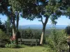

Favourite
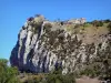
Vals rock church
| Municipality | Arvigna |
|---|---|
| Postcode | 09100 |
| Latitude | 43.0636111 (N 43° 3’ 49”) |
| Longitude | 1.7330556 (E 1° 43’ 59”) |
| Altitude | From 279m to 490m |
| Surface area | 8.60 km² |
| Population | 224 inhabitants |
| Density | 26 inhabitants/km² |
| Prefecture | Foix (27 km, 28 min) |
| Insee code | 09022 |
| Intercommunality | CC des Portes d'Ariège Pyrénées |
| Department | Ariège |
| Territories | Midi-Pyrénées, Pyrenees |
| Region | Occitanie |
| Les Issards | 2.4 km (5 min) |
|---|---|
| Vira | 3.1 km (5 min) |
| Calzan | 4.4 km (7 min) |
| Rieucros | 5.3 km (9 min) |
| Les Pujols | 5.3 km (6 min) |
| Saint-Amadou | 6.7 km (9 min) |
| Vals | 7.7 km (11 min) |
| Tourtrol | 8 km (10 min) |
| Ludiès | 8 km (10 min) |
| Teilhet | 8.1 km (10 min) |
| Malléon | 8.2 km (13 min) |
| Dun | 8.3 km (11 min) |
| Viviès | 8.6 km (11 min) |
| Le Carlaret | 9.6 km (14 min) |
| Last name | Activity type | Rate | City |
|---|---|---|---|
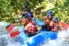 | Sports sensations | 35 € to 40 € | Alet-les-Bains (43 km) |
| Last name | Outing type | Difficulty | Duration | Departure municipality |
|---|---|---|---|---|
 | Hike | Easy | 3:00 | Ludiès (6.3 km) |
 | Mountain bike itinerary | Intermediate | 8:00 | Mirepoix (11.9 km) |
 | Hike | Intermediate | 2:00 | Belloc (17 km) |
 | Hike | Easy | 4:00 | La Bastide-de-Sérou (25 km) |
 | Hike | Intermediate | 3:30 | Roquefeuil (34 km) |