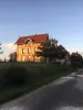

Favourite
The Chapel of Notre-Dame du Haut


| Municipality | Athesans-Étroitefontaine |
|---|---|
| Postcode | 70110 |
| Latitude | 47.5967942 (N 47° 35’ 48”) |
| Longitude | 6.5096004 (E 6° 30’ 35”) |
| Altitude | From 269m to 367m |
| Surface area | 12.88 km² |
| Population | 654 inhabitants |
| Density | 50 inhabitants/km² |
| Prefecture | Vesoul (33 km, 38 min) |
| Insee code | 70031 |
| Intercommunality | CC du Pays de Villersexel |
| Department | Haute-Saône |
| Territory | Franche-Comté |
| Region | Burgundy-Franche-Comté |
| La Vergenne | 2 km (3 min) |
|---|---|
| Le Val-de-Gouhenans | 3.4 km (5 min) |
| Villafans | 3.5 km (6 min) |
| Mignavillers | 4.2 km (8 min) |
| Senargent-Mignafans | 4.4 km (7 min) |
| Moffans-et-Vacheresse | 5.3 km (8 min) |
| Gouhenans | 5.4 km (8 min) |
| Longevelle | 5.9 km (11 min) |
| Saint-Sulpice | 6.4 km (8 min) |
| Les Aynans | 6.5 km (9 min) |
| Granges-la-Ville | 7.2 km (11 min) |
| Vouhenans | 7.5 km (9 min) |
| Faymont | 7.9 km (13 min) |
| Beveuge | 8 km (12 min) |


| Last name | Activity type | Rate | City |
|---|---|---|---|
 | Culture and education | 11 € | Le Thillot (36 km) |
 | Arts and Crafts | 12 € | Basse-sur-le-Rupt (48 km) |
| Last name | Outing type | Difficulty | Duration | Departure municipality |
|---|---|---|---|---|
 | Hike | Easy | 1:00 | Pays-de-Clerval (23 km) |
 | Hike | Intermediate | 35 min | Grand-Charmont (25 km) |
 | Hike | Easy | 1:05 | Ferrières-lès-Scey (38 km) |
 | Hike | Easy | 1:00 | Sewen (38 km) |
 | Hike | Intermediate | 2:30 | Kirchberg (40 km) |