

Favourite
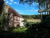
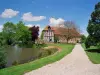
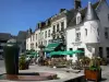
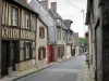
Mortagne-au-Perche
| Municipality | Auguaise |
|---|---|
| Postcode | 61270 |
| Latitude | 48.7009940 (N 48° 42’ 4”) |
| Longitude | 0.5538590 (E 0° 33’ 14”) |
| Altitude | From 245m to 281m |
| Surface area | 2.25 km² |
| Population | 212 inhabitants |
| Density | 94 inhabitants/km² |
| Prefecture | Alençon (52 km, 52 min) |
| Insee code | 61012 |
| Intercommunality | CC des Pays de L'Aigle |
| Department | Orne |
| Territory | Perche |
| Region | Normandy |
| Brethel | 2.8 km (5 min) |
|---|---|
| Les Aspres | 3.9 km (5 min) |
| Écorcei | 4.2 km (5 min) |
| Bonnefoi | 4.5 km (6 min) |
| Aube | 5.4 km (8 min) |
| Les Genettes | 5.9 km (9 min) |
| Le Ménil-Bérard | 5.9 km (10 min) |
| La Ferrière-au-Doyen | 6.3 km (6 min) |
| La Chapelle-Viel | 6.3 km (10 min) |
| Rai | 8.4 km (9 min) |
| Bonsmoulins | 8.4 km (9 min) |
| Moulins-la-Marche | 9.2 km (8 min) |
| Crulai | 9.3 km (12 min) |
| L'Aigle | 9.9 km (11 min) |
| Last name | Activity type | Rate | City |
|---|---|---|---|
 | Sports sensations | 22 € to 75 € | Fontaine-Simon (40 km) |
| Last name | Outing type | Difficulty | Duration | Departure municipality |
|---|---|---|---|---|
 | Hike | Easy | 3:25 | Saint-Longis (42 km) |
 | Hike | Easy | 3:00 | Asnières (56 km) |
 | Hike | Easy | 3:45 | Jauzé (56 km) |
 | Hike | Easy | 55 min | Bonnétable (59 km) |