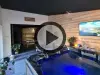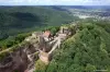

Favourite
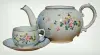
Lorraine faience pottery
| Municipality | Azoudange |
|---|---|
| Postcode | 57810 |
| Latitude | 48.7386840 (N 48° 44’ 19”) |
| Longitude | 6.8121790 (E 6° 48’ 44”) |
| Altitude | From 217m to 302m |
| Surface area | 15.73 km² |
| Population | 130 inhabitants |
| Density | 8 inhabitants/km² |
| Prefecture | Metz (73 km, 1:13) |
| Insee code | 57044 |
| Intercommunality | CC Sarrebourg Moselle Sud |
| Department | Moselle |
| Territory | Lorraine |
| Region | Great East |
| Maizières-lès-Vic | 3.7 km (6 min) |
|---|---|
| Languimberg | 4.8 km (6 min) |
| Assenoncourt | 5 km (8 min) |
| Bourdonnay | 7.2 km (7 min) |
| Fribourg | 8.2 km (10 min) |
| Rhodes | 8.3 km (9 min) |
| Moussey | 8.9 km (9 min) |
| Tarquimpol | 9.3 km (15 min) |
| Guermange | 9.5 km (15 min) |
| Gelucourt | 10.2 km (11 min) |
| Diane-Capelle | 10.7 km (10 min) |
| Desseling | 10.7 km (14 min) |
| Ommeray | 10.9 km (11 min) |
| Lagarde | 11.3 km (11 min) |
| Last name | Outing type | Difficulty | Duration | Departure municipality |
|---|---|---|---|---|
 | Hike | Easy | 3:25 | Réchicourt-le-Château (5.7 km) |
 | Hike | Easy | 35 min | Sarrebourg (17.7 km) |
 | Hike | Intermediate | 5:25 | Saint-Quirin (23 km) |
 | Hike | Intermediate | 4:05 | Walscheid (27 km) |
 | Hike | Intermediate | 3:35 | Walscheid (27 km) |