Liven up your holidays!

Chamesol

Tourism, holidays & weekends guide in the Doubs

Chamesol - Tourism, holidays & weekends guide in the Doubs
7.2
5

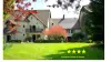
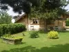
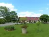
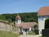
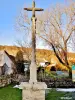
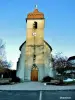
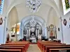
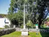
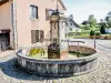
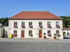
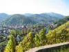
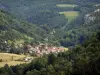
Chamesol is located on a plateau at the foot of the ridge Lomont. The origin of the name probably refers to the sun, because of its location on the plateau above the valley of the Doubs. Town to explore on foot thanks to GR5 and LWG running through it.

Geographical information

MunicipalityChamesol
Postcode25190
Tourism label
Latitude47.3474500 (N 47° 20’ 51”)
Longitude6.8348500 (E 6° 50’ 5”)
AltitudeFrom 400m to 835m
Surface area10.21 km²
Population396 inhabitants
Density38 inhabitants/km²
PrefectureBesançon (98 km, 1:16)
Insee code25114
IntercommunalityCC du Pays de Maîche
DepartmentDoubs
TerritoriesFranche-Comté, Jura mountains
RegionBurgundy-Franche-Comté

Nearest cities & towns

Montécheroux3.4 km (7 min)
Liebvillers7.2 km (13 min)
Pierrefontaine-lès-Blamont7.4 km (15 min)
Saint-Hippolyte7.4 km (12 min)
Blamont9.9 km (18 min)
Villars-lès-Blamont10.2 km (18 min)
Noirefontaine11.1 km (18 min)
Villars-sous-Dampjoux11.3 km (19 min)
Soulce-Cernay11.5 km (20 min)
Bief11.6 km (17 min)
Dampjoux12.1 km (20 min)
Roches-lès-Blamont12.8 km (23 min)
Autechaux-Roide13.6 km (25 min)
Dannemarie13.8 km (26 min)
Feule13.8 km (22 min)

Things to see and do

Discover: six fountains ; St. Ermenfroy church with its reliquary from the catacombs of St. Callixtus in Rome and whose relics are attributed to St. Desire.

See rock arch on the edge of cliff locality Viaton. Prudence, the cliff is impressive.

Photos

The village
The village
See photo
The same fountain, to the other side (© J.E)
See photo
Church St. Ermenfroy (© J.E)
See photo
Chamesol, saw the monument of the 1944 parachute operations (© J.E)
See photo
The twisted cross in front of the church
See photo
View Chamesol (© Jean Espirat)
See photo
Fountain at the entrance of the village (© Jean Espirat)
See photo
Fountain in the center of the village (© Jean Espirat)
See photo
Fountain at the bottom of the village, in the East (© Jean Espirat)
See photo
The Twisted Cross (© Jean Espirat)
See photo
The Twisted Cross (© Jean Espirat)
See photo
Church Chamesol (© Jean Espirat)
See photo
Nave of the Church (© Jean Espirat)
See photo
Information on the twisted cross (© Jean Espirat)
See photo
rock arch in the locality Viaton (© Jean Espirat)
See photo
rock arch in the locality Viaton (© Jean Espirat)
See photo
Altar and altarpiece of the Sacred Heart - Church of Chamesol (© J.E)
See photo
Key lintel dated 1835 (© J.E)
See photo
Key lintel dated 1834 (© J.E)
See photo
Twisted Cross, the old cemetery (© J.E)
See photo
A village fountains (© J.E)
See photo
Church History Chamesol (© J.E)
See photo
Lintel dated 1561 (© J.E)
See photo
Lintel dated 1738 (© J.E)
See photo
Lintel dated 1817 (© J.E)
See photo
Mayor of Chamesol (© J.E)
See photo
Altar and altarpiece of the church of Chamesol (© J.E)
See photo
Monument parachute operations of August and September 1944 (© J.E)
See photo
Monument parachute operations (© J.E)
See photo
Reliquary exposing the remains (presumed) Saint-Désiré (© J.E)
See photo
Statue of the Virgin in the church (© J.E)
See photo

Weather

Monday 20 may
Min. 7°C - Max. 19°C
Day
Night
Tuesday 21 may
Min. 11°C - Max. 13°C
Day
Night
Wednesday 22 may
Min. 10°C - Max. 13°C
Day
Night

Visits, leisure and activities nearby

Outings

Last nameOuting typeDifficultyDurationDeparture municipality
Walk to Fort Lachaux- Grand-Charmont, Sochaux, Montbéliard
HikeIntermediate35 minGrand-Charmont (19.2 km)
Reposoir Chapel
HikeEasy1:00Pays-de-Clerval (26 km)
Rangen massif
HikeIntermediate1:00Burnhaupt-le-Haut (49 km)
Tour of the historic centre
Village visitEasy1:00Masevaux-Niederbruck (49 km)
Sattelboden Chalet
HikeIntermediate3:00Masevaux-Niederbruck (49 km)

Restaurants

Bed & breakfasts

Vacation rentals

Campsites

Hotels

Your holidays
A hotel
A vacation rental
A bed & breakfast
A campsite
A leisure activity
A restaurant
A rental car
A plane ticket
By continuing to browse our site, you are agreeing to the use of cookies to improve your experience and make targeted offers.
Find out more and make settings
Your account