
Favourite
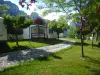
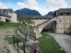
Silver mines at L'Argentière-la-Bessée
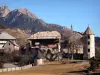
| Municipality | Champcella |
|---|---|
| Postcode | 05310 |
| Latitude | 44.7236880 (N 44° 43’ 25”) |
| Longitude | 6.5719370 (E 6° 34’ 19”) |
| Altitude | From 900m to 3156m |
| Surface area | 30.25 km² |
| Population | 189 inhabitants |
| Density | 6 inhabitants/km² |
| Prefecture | Gap (65 km, 1:04) |
| Insee code | 05031 |
| Intercommunality | CC du Pays des Ecrins |
| Department | Hautes-Alpes |
| Territories | Alps, Dauphiné |
| Region | Provence-Alps-French Riviera |
| Freissinières | 5.5 km (10 min) |
|---|---|
| La Roche-de-Rame | 5.6 km (10 min) |
| Saint-Crépin | 6.5 km (12 min) |
| L'Argentière-la-Bessée | 10.1 km (15 min) |
| Eygliers | 11.6 km (19 min) |
| Mont-Dauphin | 12.6 km (20 min) |
| Réotier | 13.1 km (23 min) |
| Guillestre | 14.3 km (21 min) |
| Les Vigneaux | 14.8 km (20 min) |
| Saint-Clément-sur-Durance | 14.8 km (19 min) |
| Risoul | 15.7 km (23 min) |
| Saint-Martin-de-Queyrières | 16.2 km (23 min) |
| Puy-Saint-Vincent | 18.4 km (25 min) |
| Châteauroux-les-Alpes | 21 km (25 min) |
| Last name | Activity type | Rate | City |
|---|---|---|---|
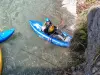 | Sports sensations | 41 € | Saint-Clément-sur-Durance (8.3 km) |
 | Sports sensations | 38 € | Saint-Clément-sur-Durance (8.3 km) |
 | Sports sensations | 40 € | Saint-Clément-sur-Durance (8.3 km) |
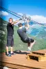 | Sports sensations | 30 € | L'Argentière-la-Bessée (9.1 km) |
 | Sports sensations | 45 € | Guillestre (9.3 km) |
| Last name | Outing type | Difficulty | Duration | Departure municipality |
|---|---|---|---|---|
 | Hike | Easy | 6:40 | Champoléon (25 km) |
| Cycling itinerary | Athletic | 4:10 | Saint-Jean-Saint-Nicolas (28 km) |
 | Hike | Easy | 2:30 | Ancelle (31 km) |
 | Hike | Athletic | 3:00 | Ancelle (31 km) |
| Hike | Intermediate | 4:30 | Ancelle (31 km) |