Liven up your holidays!

Champlitte

Tourism, holidays & weekends guide in the Haute-Saône

Champlitte - Tourism, holidays & weekends guide in the Haute-Saône
8.0
5

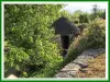
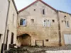
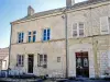
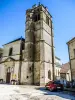
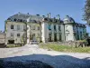
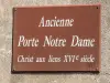
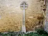
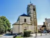
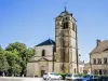
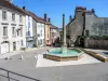
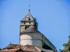
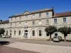
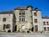
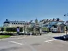
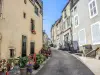
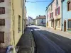
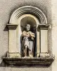
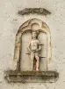
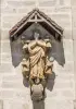
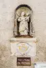
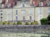
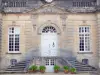
The small town of Champlitte is a very rich city in its architecture and heritage. All eras have left substantial remains, authentic and well preserved: the castle of the sixteenth and eighteenth centuries, Renaissance houses of the Place des Halles, winegrowers streets and cobbled streets.

Former defensive point of support of the county of Burgundy, set on a promontory 240 meters above sea level, the territory of Champlitte is a crossroads for the three provinces that are the Champagne-Ardenne, Burgundy and Franche-Comté. It is located 50 minutes from the A5 motorway Paris Langres Dijon Lyon and 30 minutes from the A31 Langres Metz Nancy Luxembourg Belgium.

With a rich historical and architectural heritage that has preserved over the centuries, it is also its wine production, which carries the colors of the village beyond its territory. Also demonstrates the strong appeal of its castle and its two museums that offer a glimpse of rural society at the turn of the twentieth century and highlights the technical changes that have occurred in the late nineteenth.

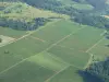
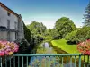
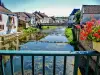
Since 2006, the Tourist Office develops hiking on a generous natural territory, suitable for this activity and rich in rare and protected plants. Not less than 20 circuits located throughout the township, a total of 300 km of marked trails, regularly maintained, awaiting hikers.

Champlitte is also an essential step of the Via Francigena, and offers pilgrims a map of the territory and all accommodation and services needed to conduct their passage.

With a constantly changing offers, the Champlitte region is a land known for hiking lovers exceptional natural environments.

His houses, hotels and camping can accommodate the public, solo, duo, family or group.

Geographical information

MunicipalityChamplitte
Postcode70600
Tourism label
Latitude47.6167280 (N 47° 37’ 0”)
Longitude5.5132150 (E 5° 30’ 48”)
AltitudeFrom 208m to 379m
Surface area128.90 km²
Population1666 inhabitants
Density12 inhabitants/km²
PrefectureVesoul (68 km, 1:05)
Insee code70122
IntercommunalityCC des Quatre Rivières
DepartmentHaute-Saône
TerritoryFranche-Comté
RegionBurgundy-Franche-Comté

Nearest cities & towns

Champlitte-la-Ville2.1 km (5 min)
Orain6.9 km (9 min)
Framont7.6 km (9 min)
Écuelle8.5 km (7 min)
Courtesoult-et-Gatey10 km (17 min)
Percey-le-Grand10 km (12 min)
Montigny-Mornay-Villeneuve-sur-Vingeanne10.2 km (11 min)
Oyrières10.2 km (8 min)
Achey10.4 km (12 min)
Pierrecourt10.6 km (13 min)
Coublanc10.7 km (16 min)
Vars10.9 km (11 min)
Pouilly-sur-Vingeanne11.2 km (12 min)
Maâtz12.2 km (18 min)
Delain12.7 km (15 min)

Things to see and do

For information, the Tourist Office is located opposite the castle. Information +33 3 84 67 67 19.

Places of interest

Information points
Leisure centres
Monuments
Natural sites

Events and festivities

Rendez-Vous du Terroir au Domaine Henriot

Photos

Champlitte, seen from the Pierrecourt road (© J.E)
See photo
The church
The church
See photo
Fountain, Hall Square (© J.E)
See photo
The castle of Champlitte
See photo
Champlitte, seen from the Pierrecourt road (© J.E)
See photo
Dry lawns
Dry lawns
See photo
Hiking trails
Hiking trails
See photo
Bridge of champlitte, seen from the bridge downstream (© J.E)
See photo
ATV
ATV
See photo
Coteaux
Coteaux
See photo
Bike and Run in July
See photo
Chanitte's comparison
See photo
Small town of Franche-Comté with character
See photo
The cabordes
The cabordes
See photo
Old Houses of the Chapter (© J.E)
See photo
Old Houses of the Chapter (© J.E)
See photo
Belfry of the church (© J.E)
See photo
Castle of Champlitte (© J.E)
See photo
Christ with ties (© J.E)
See photo
Christ with links, information (© J.E)
See photo
Ornamented cross, passage of the Leue (© J.E)
See photo
St. Christopher Church (© J.E)
See photo
St. Christopher Church (© J.E)
See photo
Fountain, at the top of the village street (© J.E)
See photo
Belfry of the church, seen from the bottom of the village (© J.E)
See photo
The Salon, upstream of the Champlitte bridge (© J.E)
See photo
The Salon, downstream of the Champlitte bridge (© J.E)
See photo
Champlitte town hall (© J.E)
See photo
House called Spanish (© J.E)
See photo
Museum of Champlitte (© J.E)
See photo
Rue des Cures (© J.E)
See photo
Pasteur Street at Champlitte (© J.E)
See photo
Sculpture, against a wall (© J.E)
See photo
Statue, rue de la breche (© J.E)
See photo
Statue of San Sebastián (© J.E)
See photo
Statue, at the top of the village street (© J.E)
See photo
Virgin and Child (© J.E)
See photo

Weather

Monday 20 may
Min. 9°C - Max. 23°C
Day
Night
Tuesday 21 may
Min. 13°C - Max. 17°C
Day
Night
Wednesday 22 may
Min. 12°C - Max. 16°C
Day
Night

Visits, leisure and activities nearby

Leisure activities

Last nameActivity typeRateCity
Guided bike ride in the Burgundy vineyard
Nature and the great outdoors49 € Dijon (48 km)

Outings

Last nameOuting typeDifficultyDurationDeparture municipality
Around Charmeval
Cycling itineraryEasy1:40Grandchamp (12.7 km)
Around Cusey
Cycling itineraryEasy1:25Cusey (13.1 km)
The Chaudière Hollow
HikeEasy3:45Dommarien (14.8 km)
From the Niche to Montsaugeon
Cycling itineraryEasy1:45Dommarien (14.8 km)
The Great Charms
HikeEasy4:50Le Montsaugeonnais (17.5 km)

Restaurants

Bed & breakfasts

Vacation rentals

Campsites

Hotels

Your holidays
A hotel
A vacation rental
A bed & breakfast
A campsite
A leisure activity
A restaurant
A rental car
A plane ticket
By continuing to browse our site, you are agreeing to the use of cookies to improve your experience and make targeted offers.
Find out more and make settings
Your account