
Favourite
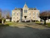
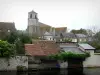
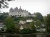
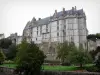
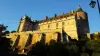
Brou
| Municipality | Chapelle-Royale |
|---|---|
| Postcode | 28290 |
| Tourism label | ") |
| Latitude | 48.1433170 (N 48° 8’ 36”) |
| Longitude | 1.0539310 (E 1° 3’ 14”) |
| Altitude | From 158m to 192m |
| Surface area | 9.89 km² |
| Population | 300 inhabitants |
| Density | 30 inhabitants/km² |
| Prefecture | Chartres (60 km, 50 min) |
| Insee code | 28079 |
| Intercommunality | CC du Perche |
| Department | Eure-et-Loir |
| Territory | Perche |
| Region | Centre-Loire Valley |
| La Bazoche-Gouet | 5.7 km (6 min) |
|---|---|
| Les Autels-Villevillon | 6.8 km (9 min) |
| Vald'Yerre | 7.6 km (7 min) |
| Le Gault-du-Perche | 8.3 km (9 min) |
| Moulhard | 8.7 km (14 min) |
| Unverre | 9.1 km (11 min) |
| Dampierre-sous-Brou | 11.3 km (13 min) |
| Chapelle-Guillaume | 11.9 km (13 min) |
| Brou | 12.4 km (13 min) |
| Luigny | 13.2 km (15 min) |
| Le Poislay | 13.3 km (17 min) |
| Charbonnières | 13.4 km (16 min) |
| Yèvres | 14 km (15 min) |
| La Fontenelle | 14.2 km (15 min) |
| Authon-du-Perche | 15.2 km (16 min) |
| Last name | Activity type | Rate | City |
|---|---|---|---|
 | Sports sensations | 22 € to 75 € | Fontaine-Simon (41 km) |
| Last name | Outing type | Difficulty | Duration | Departure municipality |
|---|---|---|---|---|
 | Village visit | Easy | 1:00 | Châteaudun (22 km) |
 | Hike | Easy | 3:00 | Châteaudun (22 km) |
 | Hike | Intermediate | 2:45 | Nonvilliers-Grandhoux (24 km) |
| Cycling itinerary | Easy | 2:00 | Lunay (39 km) |
 | Hike | Easy | 55 min | Bonnétable (47 km) |