

Favourite
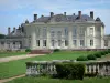
The Robert Tatin Museum
| Municipality | Courbeveille |
|---|---|
| Postcode | 53230 |
| Latitude | 47.9923240 (N 47° 59’ 32”) |
| Longitude | -0.8878050 (W 0° 53’ 16”) |
| Altitude | From 77m to 116m |
| Surface area | 18.02 km² |
| Population | 651 inhabitants |
| Density | 36 inhabitants/km² |
| Prefecture | Laval (14.6 km, 17 min) |
| Insee code | 53082 |
| Intercommunality | CC du Pays de Craon |
| Department | Mayenne |
| Territory | Maine |
| Region | Pays de la Loire |
| Ahuillé | 3.5 km (5 min) |
|---|---|
| Cossé-le-Vivien | 6 km (9 min) |
| Astillé | 6.7 km (10 min) |
| Montjean | 8.6 km (11 min) |
| Montigné-le-Brillant | 8.9 km (12 min) |
| Cosmes | 9.5 km (12 min) |
| Loiron-Ruillé | 10.5 km (14 min) |
| Méral | 11.1 km (16 min) |
| Beaulieu-sur-Oudon | 11.7 km (18 min) |
| Nuillé-sur-Vicoin | 12.8 km (17 min) |
| L'Huisserie | 13.4 km (14 min) |
| Saint-Berthevin | 13.5 km (17 min) |
| Simplé | 13.8 km (17 min) |
| Athée | 13.9 km (16 min) |
| Last name | Outing type | Difficulty | Duration | Departure municipality |
|---|---|---|---|---|
 | Village visit | Easy | 2:00 | La Roche-Neuville (16.3 km) |
 | Hike | Easy | 1:45 | Prée-d'Anjou (16.7 km) |
 | Hike | Easy | 3:00 | Saint-Denis-d'Anjou (40 km) |
 | Hike | Intermediate | 3:00 | Piré-Chancé (40 km) |
 | Hike | Intermediate | 2:45 | Châteaugiron (46 km) |