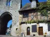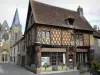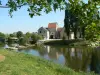


Déols is a French commune located in the Indre department in central France, Loire Valley.
The town is located in the center of the department, in the natural region of the Champagne Berry. It belongs to the urban area of Châteauroux and the urban unit of Châteauroux.
The surrounding communities and leaders towns are: Chateauroux (2 km), Quince (6 km), Montierchaume (6 km), Saint-Maur (6 km), Le Poinçonnet (7 km), Étrechet (8 km) Diors (9 km), Vineuil (10 km), Issoudun (25 km), La Châtre (35 km) and Le Blanc (54 km).
The first traces of human presence on the plateau north of Châteauroux back to the Lower Palaeolithic (bifacial and a scraper). The Middle Palaeolithic is represented in the residual state in the form of a Mousterian of Acheulean Tradition. The Upper Paleolithic appear the first pseudo-concentrations generally low on sandy elevations evenly distributed throughout the plateau.
Several interventions preventive archeology has uncovered and search on the territory of the town: an enclosure of the late Neolithic to the Montet in 1994, superimposed on a Epipaleolithic occupation; pits and silos of the Bronze Age at the site of the new cemetery, rue Fleuranderie; a protohistoric circular enclosure, Désiré-Picard street in 2004; a Gallic farm, the "BIA Grandéols" in 2010; rural housing the High Middle Ages, the Grand Brelay in 1996.
")