


Favourite
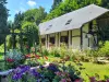
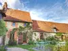
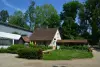
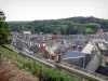
Poix-de-Picardie
| Municipality | Fourcigny |
|---|---|
| Postcode | 80290 |
| Latitude | 49.7594020 (N 49° 45’ 34”) |
| Longitude | 1.8248610 (E 1° 49’ 29”) |
| Altitude | From 193m to 214m |
| Surface area | 4.55 km² |
| Population | 202 inhabitants |
| Density | 44 inhabitants/km² |
| Prefecture | Amiens (39 km, 38 min) |
| Insee code | 80340 |
| Intercommunality | CC Somme Sud-Ouest |
| Department | Somme |
| Territory | Picardy |
| Region | Hauts-de-France |
| Marlers | 1.9 km (3 min) |
|---|---|
| Escles-Saint-Pierre | 2.7 km (5 min) |
| Fouilloy | 3.5 km (5 min) |
| Lignières-Châtelain | 4 km (7 min) |
| Gauville | 4.1 km (6 min) |
| Morvillers-Saint-Saturnin | 4.8 km (7 min) |
| Meigneux | 5.4 km (9 min) |
| Caulières | 6.1 km (9 min) |
| Gourchelles | 6.4 km (10 min) |
| Aumale | 7.1 km (10 min) |
| Sainte-Segrée | 7.2 km (11 min) |
| Quincampoix-Fleuzy | 7.3 km (12 min) |
| Romescamps | 7.6 km (10 min) |
| Bettembos | 7.6 km (12 min) |
| Last name | Activity type | Rate | City |
|---|---|---|---|
 | Nature and the great outdoors | 10 € to 18 € | Saint-Valery-sur-Somme (48 km) |
 | Sports sensations | 45 € to 105 € | Saint-Valery-sur-Somme (50 km) |
| Last name | Outing type | Difficulty | Duration | Departure municipality |
|---|---|---|---|---|
 | Village visit | Easy | 2:00 | Saint-Maulvis (16.3 km) |
 | Hike | Intermediate | 4:00 | Courcelles-sous-Moyencourt (16.8 km) |
| Hike | Easy | 3:00 | Courcelles-sous-Moyencourt (16.8 km) |
 | Hike | Easy | 1:30 | Saint-Léger-aux-Bois (17.4 km) |
 | Hike | Easy | 2:30 | Saint-Léger-aux-Bois (17.5 km) |