

Favourite
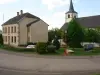
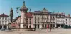
The Centre Pompidou-Metz
| Municipality | Hémilly |
|---|---|
| Postcode | 57690 |
| Tourism label | ") |
| Latitude | 49.0527340 (N 49° 3’ 10”) |
| Longitude | 6.5037070 (E 6° 30’ 13”) |
| Altitude | From 238m to 293m |
| Surface area | 14.04 km² |
| Population | 145 inhabitants |
| Density | 10 inhabitants/km² |
| Prefecture | Metz (38 km, 35 min) |
| Insee code | 57313 |
| Intercommunality | CC du District Urbain de Faulquemont |
| Department | Moselle |
| Territory | Lorraine |
| Region | Great East |
| Guinglange | 3.9 km (7 min) |
|---|---|
| Arriance | 5.1 km (9 min) |
| Elvange | 6.6 km (10 min) |
| Servigny-lès-Raville | 6.7 km (12 min) |
| Villers-Stoncourt | 7.2 km (12 min) |
| Herny | 7.9 km (14 min) |
| Fouligny | 7.9 km (15 min) |
| Flétrange | 7.9 km (14 min) |
| Haute-Vigneulles | 8.2 km (15 min) |
| Many | 8.3 km (14 min) |
| Chanville | 9 km (13 min) |
| Créhange | 9.7 km (19 min) |
| Raville | 9.8 km (16 min) |
| Bionville-sur-Nied | 10 km (17 min) |
| Marange-Zondrange | 10.6 km (15 min) |
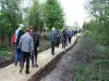
| Natural sites |
|---|
| Last name | Outing type | Difficulty | Duration | Departure municipality |
|---|---|---|---|---|
 | Hike | Easy | 30 min | Ham-sous-Varsberg (17.5 km) |
 | Hike | Easy | 2:00 | Berviller-en-Moselle (27 km) |
 | Hike | Easy | 2:00 | Jeandelaincourt (30 km) |
 | Hike | Easy | 1:20 | Pont-à-Mousson (37 km) |
 | Hike | Easy | 3:25 | Réchicourt-le-Château (46 km) |