Liven up your holidays!

Raedersdorf

Tourism, holidays & weekends guide in the Haut-Rhin

Raedersdorf - Tourism, holidays & weekends guide in the Haut-Rhin
8.5
4

Geographical information

MunicipalityRaedersdorf
Postcode68480
Tourism label
Latitude47.4743660 (N 47° 28’ 28”)
Longitude7.3673990 (E 7° 22’ 3”)
AltitudeFrom 419m to 784m
Surface area7.39 km²
Population515 inhabitants
Density69 inhabitants/km²
PrefectureColmar (81 km, 1:07)
Insee code68259
IntercommunalityCC Sundgau
DepartmentHaut-Rhin
TerritoryAlsace
RegionGreat East

Nearest cities & towns

Lutter1.4 km (2 min)
Sondersdorf3.3 km (6 min)
Oltingue3.6 km (5 min)
Wolschwiller3.7 km (6 min)
Ligsdorf5 km (7 min)
Fislis6 km (9 min)
Linsdorf6.2 km (11 min)
Bettlach6.2 km (9 min)
Ferrette6.8 km (10 min)
Kiffis7 km (12 min)
Biederthal7.3 km (12 min)
Werentzhouse8.1 km (12 min)
Vieux-Ferrette8.3 km (14 min)
Bouxwiller8.4 km (12 min)
Bendorf8.9 km (14 min)

Things to see and do

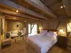
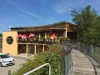
Discovery trail botanical forest animals carved wood.
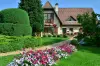
Places of interest

Monuments

Photos

The municipality
The municipality
See photo
Discovery Trail
Discovery Trail
See photo
Stork enclosure
Stork enclosure
See photo
Raedersdorf, seen from the Mariabrunn Chapel (© J.E)
See photo
The municipality
The municipality
See photo
Fountain, in front of the church of Raedersdorf (© J.E)
See photo
St. Stephen's Church of Raedersdorf (© J.E)
See photo
The Ill, upstream of the bridge of Raedersdorf (© J.E)
See photo
The Ill, downstream from the bridge of Raedersdorf (© J.E)
See photo
Callinet organ of the church (© J.E)
See photo
Altar and altarpiece of the Virgin - Church of Raedersdorf (© J.E)
See photo
Altar and altarpiece of St. Joseph (© J.E)
See photo
Church Pulpit (© J.E)
See photo
St. Stephen's Church (© J.E)
See photo
Town Hall of Raedersdorf (© J.E)
See photo
High altar and altarpiece of the church of Raedersdorf (© J.E)
See photo
Nave of the church of Raedersdorf (© J.E)
See photo
Pietà, in the church of Raedersdorf (© J.E)
See photo
Rue de Lutter - Raedersdorf (© J.E)
See photo
The municipality
The municipality
See photo
The municipality
The municipality
See photo
The municipality
The municipality
See photo
The church
The church
See photo
Saint Clemens
Saint Clemens
See photo
Sainte Clara
Sainte Clara
See photo
The municipality
The municipality
See photo

Weather

Friday 31 may
Min. 9°C - Max. 13°C
Day
Night
Saturday 1 june
Min. 11°C - Max. 15°C
Day
Night
Sunday 2 june
Min. 12°C - Max. 17°C
Day
Night

Visits, leisure and activities nearby

Outings

Last nameOuting typeDifficultyDurationDeparture municipality
Rangen massif
HikeIntermediate1:00Burnhaupt-le-Haut (33 km)
Walk to Fort Lachaux- Grand-Charmont, Sochaux, Montbéliard
HikeIntermediate35 minGrand-Charmont (41 km)
The Rangen massif
HikeIntermediate1:05Thann (42 km)
Tour of the historic centre
Village visitEasy1:00Masevaux-Niederbruck (43 km)
Sattelboden Chalet
HikeIntermediate3:00Masevaux-Niederbruck (44 km)

Restaurants

Bed & breakfasts

Vacation rentals

Campsites

Hotels

Your holidays
A hotel
A vacation rental
A bed & breakfast
A campsite
A leisure activity
A restaurant
A rental car
A plane ticket
By continuing to browse our site, you are agreeing to the use of cookies to improve your experience and make targeted offers.
Find out more and make settings
Your account