
Favourite
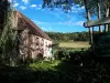
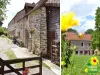
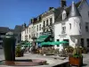
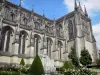
Mortagne-au-Perche
| Municipality | Saint-Agnan-sur-Sarthe |
|---|---|
| Postcode | 61170 |
| Tourism label | ") |
| Latitude | 48.6098000 (N 48° 36’ 35”) |
| Longitude | 0.4266360 (E 0° 25’ 36”) |
| Altitude | From 165m to 238m |
| Surface area | 6.24 km² |
| Population | 92 inhabitants |
| Density | 14 inhabitants/km² |
| Prefecture | Alençon (36 km, 36 min) |
| Insee code | 61360 |
| Intercommunality | CC de la Vallée de la Haute Sarthe |
| Department | Orne |
| Territory | Perche |
| Region | Normandy |
| Saint-Aubin-de-Courteraie | 1.9 km (3 min) |
|---|---|
| Le Plantis | 4.4 km (9 min) |
| Champeaux-sur-Sarthe | 4.9 km (9 min) |
| Sainte-Scolasse-sur-Sarthe | 4.9 km (7 min) |
| Tellières-le-Plessis | 5.1 km (10 min) |
| Saint-Germain-de-Martigny | 5.5 km (11 min) |
| Moulins-la-Marche | 6.1 km (8 min) |
| Saint-Ouen-de-Sécherouvre | 7 km (11 min) |
| Saint-Martin-des-Pézerits | 7.6 km (10 min) |
| Laleu | 7.7 km (11 min) |
| Bures | 8.3 km (12 min) |
| Saint-Aquilin-de-Corbion | 9.2 km (13 min) |
| Mahéru | 9.2 km (12 min) |
| Fay | 9.3 km (13 min) |
| La Ferrière-au-Doyen | 9.3 km (12 min) |
| Last name | Activity type | Rate | City |
|---|---|---|---|
 | Sports sensations | 22 € to 75 € | Fontaine-Simon (45 km) |
| Last name | Outing type | Difficulty | Duration | Departure municipality |
|---|---|---|---|---|
 | Hike | Easy | 3:25 | Saint-Longis (29 km) |
 | Hike | Easy | 3:45 | Jauzé (44 km) |
 | Hike | Easy | 55 min | Bonnétable (49 km) |