
Favourite
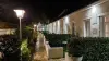
Issoudun
| Municipality | Ségry |
|---|---|
| Postcode | 36100 |
| Latitude | 46.8916090 (N 46° 53’ 30”) |
| Longitude | 2.0822569 (E 2° 4’ 56”) |
| Altitude | From 130m to 176m |
| Surface area | 33.06 km² |
| Population | 504 inhabitants |
| Density | 15 inhabitants/km² |
| Prefecture | Châteauroux (38 km, 43 min) |
| Insee code | 36215 |
| Intercommunality | CC du Pays d'Issoudun |
| Department | Indre |
| Territory | Berry |
| Region | Centre-Loire Valley |
| Chouday | 3.8 km (5 min) |
|---|---|
| Mareuil-sur-Arnon | 6.4 km (8 min) |
| Saint-Aubin | 7.9 km (14 min) |
| Condé | 9.2 km (14 min) |
| Saint-Ambroix | 9.7 km (16 min) |
| Chezal-Benoît | 9.9 km (9 min) |
| Issoudun | 10.9 km (13 min) |
| Saint-Baudel | 13.5 km (15 min) |
| Les Bordes | 14.6 km (17 min) |
| Primelles | 14.7 km (18 min) |
| Saint-Aoustrille | 15.2 km (16 min) |
| Villecelin | 15.6 km (17 min) |
| Pruniers | 16.5 km (19 min) |
| La Celle-Condé | 16.9 km (20 min) |
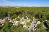
| Natural sites |
|---|
| Last name | Activity type | Rate | City |
|---|---|---|---|
 | Entertainment | 75 € to 120 € | Issoudun (9.5 km) |
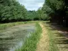
| Last name | Outing type | Difficulty | Duration | Departure municipality |
|---|---|---|---|---|
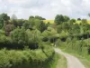
 | Hike | Easy | 2:00 | Quincy (28 km) |
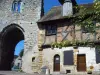 | Village visit | Easy | 2:00 | Mennetou-sur-Cher (45 km) |
 | Hike | Easy | 3:00 | Moutier-Malcard (56 km) |