
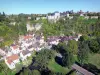

Favourite
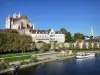
Auxerre
| Municipality | Vallan |
|---|---|
| Postcode | 89580 |
| Latitude | 47.7438340 (N 47° 44’ 38”) |
| Longitude | 3.5372520 (E 3° 32’ 14”) |
| Altitude | From 133m to 226m |
| Surface area | 11.70 km² |
| Population | 696 inhabitants |
| Density | 59 inhabitants/km² |
| Prefecture | Auxerre (7.2 km, 10 min) |
| Insee code | 89427 |
| Intercommunality | CA de l'Auxerrois |
| Department | Yonne |
| Territory | Burgundy |
| Region | Burgundy-Franche-Comté |
| Gy-l'Évêque | 2.9 km (4 min) |
|---|---|
| Chevannes | 3.9 km (9 min) |
| Vaux | 5.5 km (9 min) |
| Escamps | 7.6 km (12 min) |
| Auxerre | 7.7 km (10 min) |
| Augy | 7.9 km (13 min) |
| Escolives-Sainte-Camille | 8.1 km (10 min) |
| Jussy | 8.4 km (10 min) |
| Migé | 9.1 km (11 min) |
| Champs-sur-Yonne | 9.7 km (11 min) |
| Coulanges-la-Vineuse | 10.2 km (11 min) |
| Saint-Georges-sur-Baulche | 10.3 km (15 min) |
| Vincelles | 10.7 km (13 min) |
| Villefargeau | 10.8 km (13 min) |
| Last name | Activity type | Rate | City |
|---|---|---|---|
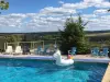
 | Sports sensations | 10 € | Joigny (29 km) |
 | Entertainment | 8 € | Chamoux (33 km) |
| Last name | Outing type | Difficulty | Duration | Departure municipality |
|---|---|---|---|---|
 | Hike | Easy | 2:30 | Lindry (10.9 km) |
 | Hike | Easy | 2:00 | Courgis (16.7 km) |
 | Hike | Easy | 20 min | Toucy (18.2 km) |
| Village visit | Easy | 3:10 | Migennes (24 km) |
 | Hike | Intermediate | 1:10 | Vézelay (35 km) |