

Favourite
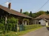
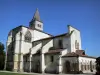
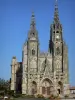
Saint-Amand-sur-Fion
| Municipality | Vanault-le-Châtel |
|---|---|
| Postcode | 51330 |
| Latitude | 48.8645880 (N 48° 51’ 53”) |
| Longitude | 4.7259350 (E 4° 43’ 33”) |
| Surface area | 34.78 km² |
| Population | 173 inhabitants |
| Density | 4 inhabitants/km² |
| Prefecture | Châlons-en-Champagne (32 km, 37 min) |
| Insee code | 51589 |
| Intercommunality | CC Côtes de Champagne et Val de Saulx |
| Department | Marne |
| Territory | Champagne-Ardenne |
| Region | Great East |
| Vanault-les-Dames | 4.6 km (7 min) |
|---|---|
| Bassu | 4.8 km (7 min) |
| Bussy-le-Repos | 7.8 km (9 min) |
| Saint-Jean-devant-Possesse | 8 km (8 min) |
| Contault | 8.5 km (13 min) |
| Sogny-en-l'Angle | 8.8 km (10 min) |
| Vernancourt | 8.8 km (12 min) |
| Le Fresne | 8.8 km (9 min) |
| Bassuet | 9.3 km (14 min) |
| Lisse-en-Champagne | 9.5 km (14 min) |
| Val-de-Vière | 9.9 km (13 min) |
| Possesse | 10 km (11 min) |
| Coupéville | 10.6 km (13 min) |
| Last name | Activity type | Rate | City |
|---|---|---|---|
 | Local flavours | 0 € to 20 € | Ambonnay (47 km) |
| Last name | Outing type | Difficulty | Duration | Departure municipality |
|---|---|---|---|---|
 | Cycling itinerary | Easy | 3:05 | Vitry-le-François (18.6 km) |
 | All-terrain bike itinerary | Easy | 3:30 | Sainte-Menehould (28 km) |
 | Cycling itinerary | Intermediate | 2:20 | Sainte-Menehould (28 km) |
 | All-terrain bike itinerary | Intermediate | 2:45 | Châlons-en-Champagne (29 km) |
 | Cycling itinerary | Easy | 3:00 | Giffaumont-Champaubert (35 km) |