
Favourite
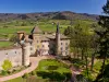
The Paray-le-Monial basilica
| Municipality | Volesvres |
|---|---|
| Postcode | 71600 |
| Tourism label | ") |
| Latitude | 46.4708630 (N 46° 28’ 15”) |
| Longitude | 4.1589980 (E 4° 9’ 32”) |
| Altitude | From 239m to 307m |
| Surface area | 21.53 km² |
| Population | 667 inhabitants |
| Density | 30 inhabitants/km² |
| Prefecture | Mâcon (65 km, 57 min) |
| Insee code | 71590 |
| Intercommunality | CC Le Grand Charolais |
| Department | Saône-et-Loire |
| Territory | Burgundy |
| Region | Burgundy-Franche-Comté |
| Paray-le-Monial | 4.7 km (9 min) |
|---|---|
| Saint-Aubin-en-Charollais | 7.9 km (10 min) |
| Hautefond | 8 km (15 min) |
| Saint-Léger-lès-Paray | 8.4 km (15 min) |
| Vitry-en-Charollais | 9.4 km (16 min) |
| Lugny-lès-Charolles | 10.6 km (13 min) |
| Saint-Vincent-Bragny | 11.5 km (15 min) |
| Palinges | 11.8 km (14 min) |
| Champlecy | 12 km (14 min) |
| Saint-Yan | 12.3 km (17 min) |
| Charolles | 12.8 km (15 min) |
| Grandvaux | 13 km (19 min) |
| Poisson | 13.1 km (17 min) |
| Changy | 13.1 km (16 min) |
| Saint-Bonnet-de-Vieille-Vigne | 14.3 km (19 min) |
| Monuments |
|---|
| Last name | Activity type | Rate | City |
|---|---|---|---|
 | Culture and education | 10 € | Saint-Point (38 km) |
| Last name | Outing type | Difficulty | Duration | Departure municipality |
|---|---|---|---|---|
 | Cycling itinerary | Easy | 2:00 | Marcigny (24 km) |
 | Hike | Easy | 1:30 | Saint-Eugène (30 km) |
 | Hike | Intermediate | 3:00 | La Boulaye (31 km) |
 | Hike | Athletic | 3:00 | Dettey (33 km) |
 | Hike | Athletic | 5:00 | Charbonnat (36 km) |