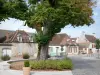
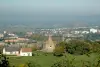
Discover: cascade Brisecou, granite chaos, farm Montmain, laundry Saint-Blaise, Mine Road with views of the upper town.

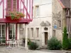
Autun

Discover: cascade Brisecou, granite chaos, farm Montmain, laundry Saint-Blaise, Mine Road with views of the upper town.
| Department | Saône-et-Loire |
|---|---|
| Departure municipality | Autun |
| Outing type | Hike |
| Difficulty | Intermediate |
| Duration | 2:00 |
| Recommended period | from january to december |
| Kilometres | 7 km |
| Altitude upon departure | 400m |
| Change in altitude | 540m |
From the Field of Mars, take the direction of the cathedral. Continue by DUFRAIGNE street and take the second left onto Racquet about a hundred meters. Then take Faubourg du Breuil and Breuil the way towards the road of Broye. At a bridle continue on the street and take Planoise immediately left the streets of the Cascade running through a hamlet with several houses. The parking lot of Stone Couhard and the start of the walk is at the end of the street.
Pierre Couhard parking place.
Opposite the church, take the left path that runs along the reach and follow it for 1 km to the bridge, which is crossed.
Turn left, and 75 m further follow the yellow signs to mount and green zigzag the 100 steps to the forest road.
Turn right and 100 meters further on a path goes left. Continue 80 meters then join the path by the steps to the left.
After 600 m turn to the right. Get off, cross the road, take the path in front and 100 meters further keep right towards Montmain.
Arriving at the farm, take the road left towards Saint Blaise. After 150 meters turn right and follow the path of the Goats for 2 km.
Continue on the road down, and after turning pin and the house take the path down to the left. At the bottom of the tar, take the 2nd left. 200 m further to the gate of the park, take the right path and follow it for 1 km up the reach.
Cross the road and go up the street and follow the Cascade reach the front of the houses left to return to the starting point