Pedestrian only - Difficulty: * - Distance: 6.7 km - Map: IGN 1339 AND TOP 25 - Interest of the circuit - Small course to test its shape before attempting the longer circuits. Go to the reservoir, nice view of the ocean and the North Lake (Lake Biscarrosse / Cazaux / Sanguinet). Itinerary - Departure D1 at the roundabout of Maguide (mark on the map D4), road of Arcachon. Follow the shared itinerary with the circuit Biscarrosse Beach to mark 1. Take on the right and follow the signs to reach the mark 2, turn right to mark 3. In 3 take the path on the left, cross the road bike path and continue until the perpendicular n ° 4, turn right and continue the path that joins the path of Cugnes passing near the tank 4. Optional: At the passage of the mark 4, leave the circuit and turn left towards of the tank. Viewpoint on the ocean and North Lake. Turn around to join the circuit. In 5 take on the right the path that goes down to D2. Cross the bike path. At D2 take the path on the right, straight until 6, turn left following the markup and take the first path right straight to join D1, the starting point. The figures from 1 to 6 are markers on the trail map - GPS coordinates in UTM - D1 640 788 4924 007 - 1 641 305 4923 741 - 2 641 690 4923 218 - 3 641 306 4922 952 - 4 641 580 4922 300 - 5 641 221 4921 959 - 6 640 253 4923 000
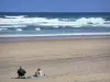
Biscarrosse-Plage


