Small, easy and quiet walk in the forest starting from the Col de Crie.

Roche de Solutré limestone escarpment
Small, easy and quiet walk in the forest starting from the Col de Crie.
| Department | Rhône |
|---|---|
| Departure municipality | Deux-Grosnes |
| Outing type | Hike |
| Difficulty | Easy |
| Duration | 1:50 |
| Recommended period | from april to september |
| Kilometres | 5 km |
| Altitude upon departure | 582m |
| Change in altitude | 112m |
Departure from Col de Crie. The path is signposted with white background signs with red marks representing a stylized Christmas tree and the letters SR (Saint-Rigaud).
Go down the D23 road towards Chénelette for 600 meters.
Then take the path on the right in the forest, this path is common to several other circuits, including the GR 7 (Red and White marking).
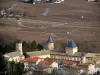
Continue on the path to the Croix des Oncins where you will leave the GR. Cross the paved road to go down opposite. After a slight right turn, you will have a view to the left of Mont Saint-Rigaud and its antenna. Then turn sharply to the right.
Continue towards the houses. You can cut a pin and take a little lower on the right a wide horizontal path, the old railway line, which will bring you back to the Col de Crie.