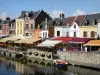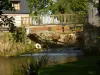


Thièvres has the particularity of being crossed by a departmental limit. Thus the "east" side is in the Somme and the "west" side in the Pas-de-Calais. There are two town halls but only one church. The D1 marking the departmental boundary is an old Roman road also called Brunehaut causeway. It connected Arras and Amiens. Thièvres hosts the confluence point of Authie and Kilienne. The Authie will then travel a hundred miles before flowing into the Channel. Three rivers bath this valley: Authie, Kilienne and Saint Pierre Creek. A picnic and relaxation area is set up at the entrance to the marsh, between Authie and Saint Pierre Creek.

The Circuit of Remembrance