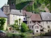
Pleasant walk especially in the spring and the autumn owing to the vegetation, sunny, beautiful views over the valleys and surrounding villages.
Pompadour Castle
Pleasant walk especially in the spring and the autumn owing to the vegetation, sunny, beautiful views over the valleys and surrounding villages.

| Department | Corrèze |
|---|---|
| Departure municipality | Concèze |
| Outing type | Hike |
| Difficulty | Intermediate |
| Duration | 3:00 |
| Recommended period | from april to november |
| Environment | Countryside |
| Kilometres | 9 km |
| Altitude upon departure | 390m |
Depart from Place de l'église, and continue towards the cemetery, yellow signposting.
Place de l'église, follow the ridge towards Bas Champs for 1.5 km then turn on to a dirt track near a lake. 100 m further on, turn left and descend to the vineyards. In the distance you will see the village of Lascaux. Near the bottom of the descent, follow the border on the left. At the next fork in the road, climb up the hairpin bends on the right. At the top of the hill, turn left on to a ridge path. Make your way to the edge of the forest on the left of the fields and follow it. Cross the fields again and enter the forest. Leave a path on the left, follow a vineyard and return to the forest. At the bottom of the descent, turn right. Continue to a road in a bend and turn right on to it. At the top of the village of Semblat, opposite a barn, take the furthest path on the left which becomes a downhill dirt track after the last houses. Join a road and follow it to the right. At the intersection, turn left towards Las Tieras (view over the valley). On the way out of the hamlet, opposite the transformer, follow the ridge on the right through the apple orchards (view over the valleys). Below the village of Champs, at the fork in the road, turn right and climb up to Las Renaudias (beautiful architecture) and return to the town.