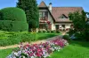
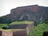
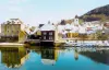
Site of the old iron mines Bethoncourt.


Favourite


| Municipality | Bethoncourt |
|---|---|
| Postcode | 25200 |
| Tourism label | ") |
| Latitude | 47.5324750 (N 47° 31’ 57”) |
| Longitude | 6.7956140 (E 6° 47’ 44”) |
| Altitude | From 315m to 410m |
| Surface area | 6.54 km² |
| Population | 5404 inhabitants |
| Density | 826 inhabitants/km² |
| Prefecture | Besançon (85 km, 59 min) |
| Insee code | 25057 |
| Intercommunality | CA Pays de Montbéliard Agglomération |
| Department | Doubs |
| Territories | Franche-Comté, Jura mountains |
| Region | Burgundy-Franche-Comté |
| Montbéliard | 2.7 km (6 min) |
|---|---|
| Grand-Charmont | 2.8 km (6 min) |
| Vyans-le-Val | 3.8 km (6 min) |
| Sochaux | 4.6 km (8 min) |
| Vieux-Charmont | 5.3 km (9 min) |
| Sainte-Suzanne | 5.5 km (10 min) |
| Allondans | 5.7 km (10 min) |
| Nommay | 5.7 km (11 min) |
| Dung | 5.7 km (11 min) |
| Courcelles-lès-Montbéliard | 5.8 km (8 min) |
| Bart | 7.1 km (12 min) |
| Dambenois | 7.3 km (14 min) |
| Étupes | 7.5 km (12 min) |
| Héricourt | 7.6 km (12 min) |
| Exincourt | 7.6 km (13 min) |
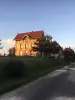
Site of the old iron mines Bethoncourt.
| Performance halls |
|---|


| Last name | Activity type | Rate | City |
|---|---|---|---|
 | Culture and education | 11 € | Le Thillot (38 km) |
| Last name | Outing type | Difficulty | Duration | Departure municipality |
|---|---|---|---|---|
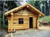
 | Hike | Intermediate | 35 min | Grand-Charmont (2.5 km) |
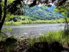
 | Hike | Easy | 1:00 | Pays-de-Clerval (27 km) |
 | Village visit | Easy | 1:00 | Masevaux-Niederbruck (31 km) |
 | Hike | Intermediate | 3:00 | Masevaux-Niederbruck (31 km) |
 | Hike | Easy | 1:00 | Sewen (32 km) |