Favourite
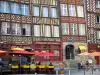
Rennes
| Municipality | Brécé |
|---|---|
| Postcode | 35530 |
| Tourism label | ") |
| Latitude | 48.1104130 (N 48° 6’ 37”) |
| Longitude | -1.4818590 (W 1° 28’ 55”) |
| Altitude | From 32m to 73m |
| Surface area | 7.16 km² |
| Population | 2083 inhabitants |
| Density | 290 inhabitants/km² |
| Prefecture | Rennes (17.4 km, 19 min) |
| Insee code | 35039 |
| Intercommunality | ME Rennes Métropole |
| Department | Ille-et-Vilaine |
| Region | Brittany |
| Servon-sur-Vilaine | 2.7 km (7 min) |
|---|---|
| Noyal-sur-Vilaine | 3.8 km (7 min) |
| Broons-sur-Vilaine | 5.7 km (11 min) |
| Acigné | 7.4 km (10 min) |
| Châteaubourg | 8.3 km (8 min) |
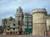
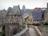
| Châteaugiron | 9.7 km (12 min) |
| Domloup | 10.1 km (11 min) |
| La Bouëxière | 10.3 km (15 min) |
| Saint-Didier | 10.7 km (11 min) |
| Cesson-Sévigné | 10.9 km (12 min) |
| Saint-Jean-sur-Vilaine | 11.7 km (12 min) |
| Domagné | 11.8 km (11 min) |
| Thorigné-Fouillard | 12.2 km (11 min) |
| Chantepie | 13.1 km (12 min) |
| Last name | Outing type | Difficulty | Duration | Departure municipality |
|---|---|---|---|---|
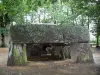
 | Hike | Intermediate | 2:45 | Châteaugiron (6.9 km) |
 | All-terrain bike itinerary | Intermediate | 2:05 | Châteaugiron (7 km) |
 | All-terrain bike itinerary | Intermediate | 2:05 | Châteaugiron (7.1 km) |
 | Hike | Intermediate | 2:30 | Thorigné-Fouillard (8.7 km) |
 | Hike | Intermediate | 2:10 | La Bouëxière (9 km) |