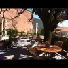


Favourite
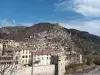
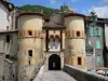
Entrevaux
| Municipality | Briançonnet |
|---|---|
| Postcode | 06850 |
| Tourism label | ") |
| Latitude | 43.8639200 (N 43° 51’ 50”) |
| Longitude | 6.7576610 (E 6° 45’ 28”) |
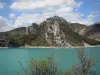
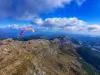
| Altitude | From 740m to 1600m |
| Surface area | 24.32 km² |
| Population | 206 inhabitants |
| Density | 8 inhabitants/km² |
| Prefecture | Nice (79 km, 1:25) |
| Insee code | 06024 |
| Intercommunality | CA du Pays de Grasse |
| Department | Alpes-Maritimes |
| Territories | Alps, French Riviera |
| Region | Provence-Alps-French Riviera |
| Amirat | 7.7 km (14 min) |
|---|---|
| Saint-Auban | 8.1 km (15 min) |
| Val-de-Chalvagne | 8.6 km (13 min) |
| Gars | 9.2 km (15 min) |
| Les Mujouls | 9.9 km (15 min) |
| Collongues | 10.3 km (15 min) |
| Sallagriffon | 14.5 km (23 min) |
| Soleilhas | 14.5 km (22 min) |
| Entrevaux | 16.2 km (26 min) |
| Ubraye | 18.4 km (28 min) |
| Caille | 19 km (35 min) |
| Peyroules | 20 km (29 min) |
| Saint-Pierre | 21 km (30 min) |
| Le Mas | 22 km (32 min) |
| Demandolx | 23 km (34 min) |
| Last name | Activity type | Rate | City |
|---|---|---|---|
 | Sports sensations | 35 € | Puget-Théniers (15.1 km) |
 | Sports sensations | 55 € | Gréolières (16.7 km) |
 | Sports sensations | 90 € to 130 € | Gréolières (17 km) |
 | Sports sensations | 50 € | Castellane (19.7 km) |
 | Sports sensations | 45 € to 85 € | Castellane (19.8 km) |
| Last name | Outing type | Difficulty | Duration | Departure municipality |
|---|---|---|---|---|
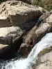
 | Hike | Intermediate | 3:30 | Thorenc (7.5 km) |
 | Hike | Easy | 2:30 | Annot (13.5 km) |
 | Hike | Athletic | 5:00 | Gréolières (16.7 km) |
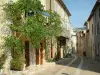
 | Village visit | Easy | 1:30 | Gréolières (16.7 km) |
 | Hike | Easy | 2:45 | Gréolières (16.7 km) |