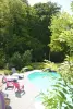

Favourite
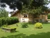
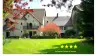
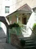
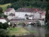
Saint-Hippolyte


| Municipality | Hyémondans |
|---|---|
| Postcode | 25250 |
| Tourism label | ") |
| Latitude | 47.3878709 (N 47° 23’ 16”) |
| Longitude | 6.6503600 (E 6° 39’ 1”) |
| Altitude | From 399m to 821m |
| Surface area | 6.87 km² |
| Population | 214 inhabitants |
| Density | 31 inhabitants/km² |
| Prefecture | Besançon (70 km, 51 min) |
| Insee code | 25311 |
| Intercommunality | CC des Deux Vallées Vertes |
| Department | Doubs |
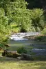
| Territories | Franche-Comté, Jura mountains |
| Region | Burgundy-Franche-Comté |
| Sourans | 3.2 km (5 min) |
|---|---|
| Goux-lès-Dambelin | 3.5 km (9 min) |
| Lanthenans | 4.7 km (8 min) |
| Dambelin | 5.3 km (8 min) |
| Blussans | 6.4 km (9 min) |
| Rémondans-Vaivre | 8.1 km (11 min) |
| Villars-sous-Écot | 8.7 km (17 min) |
| L'Isle-sur-le-Doubs | 9.8 km (14 min) |
| Anteuil | 10.1 km (12 min) |
| Rang | 10.5 km (17 min) |
| Saint-Maurice-Colombier | 10.7 km (16 min) |
| Appenans | 11.5 km (17 min) |
| Neuchâtel-Urtière | 11.9 km (16 min) |
| Médière | 11.9 km (17 min) |
| Longevelle-sur-Doubs | 12.2 km (20 min) |
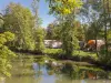
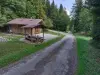
| Leisure centres |
|---|


| Last name | Outing type | Difficulty | Duration | Departure municipality |
|---|---|---|---|---|
 | Hike | Easy | 1:00 | Pays-de-Clerval (11.6 km) |
 | Hike | Intermediate | 35 min | Grand-Charmont (19.6 km) |
 | Hike | Easy | 6:00 | Devecey (48 km) |
 | Hike | Intermediate | 35 min | Hauterive-la-Fresse (49 km) |
 | Village visit | Easy | 1:00 | Masevaux-Niederbruck (50 km) |