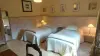

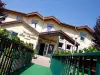
Favourite
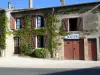
Amnéville-les-Thermes
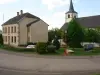
| Municipality | Lantéfontaine |
|---|---|
| Postcode | 54150 |
| Latitude | 49.2489070 (N 49° 14’ 56”) |
| Longitude | 5.9041480 (E 5° 54’ 15”) |
| Altitude | From 213m to 261m |
| Surface area | 8.06 km² |
| Population | 754 inhabitants |
| Density | 93 inhabitants/km² |
| Prefecture | Nancy (97 km, 1:12) |
| Insee code | 54302 |
| Intercommunality | CC Orne Lorraine Confluences |
| Department | Meurthe-et-Moselle |
| Territory | Lorraine |
| Region | Great East |
| Les Baroches | 2.5 km (4 min) |
|---|---|
| Val de Briey | 3.6 km (8 min) |
| Lubey | 3.6 km (3 min) |
| Moutiers | 5.7 km (9 min) |
| Ozerailles | 5.9 km (9 min) |
| Anoux | 6.1 km (9 min) |
| Fléville-Lixières | 7 km (7 min) |
| Bettainvillers | 8.3 km (12 min) |
| Valleroy | 8.4 km (12 min) |
| Auboué | 8.6 km (13 min) |
| Moineville | 8.7 km (12 min) |
| Avril | 9 km (13 min) |
| Homécourt | 9.2 km (12 min) |
| Tucquegnieux | 9.3 km (15 min) |
| Last name | Activity type | Rate | City |
|---|---|---|---|
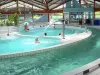
 | Entertainment | 69 € to 119 € | Ancemont (41 km) |
| Last name | Outing type | Difficulty | Duration | Departure municipality |
|---|---|---|---|---|
 | Hike | Easy | 1:20 | Pont-à-Mousson (40 km) |
 | Hike | Easy | 4:55 | Ancemont (41 km) |
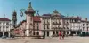
 | Village visit | Easy | 1:00 | Flirey (42 km) |
 | Hike | Easy | 2:00 | Jeandelaincourt (51 km) |
 | Hike | Easy | 2:00 | Berviller-en-Moselle (54 km) |