
Favourite
Argentomagus archaeological site
| Municipality | Rivarennes |
|---|---|
| Postcode | 36800 |
| Tourism label | ") |
| Latitude | 46.6362740 (N 46° 38’ 11”) |
| Longitude | 1.3857680 (E 1° 23’ 9”) |
| Altitude | From 88m to 171m |
| Surface area | 37.41 km² |
| Population | 520 inhabitants |
| Density | 13 inhabitants/km² |
| Prefecture | Châteauroux (34 km, 34 min) |
| Insee code | 36172 |
| Intercommunality | CC Brenne - Val de Creuse |
| Department | Indre |
| Territory | Berry |
| Region | Centre-Loire Valley |
| Chitray | 3.1 km (4 min) |
|---|---|
| Thenay | 3.8 km (6 min) |
| Saint-Gaultier | 4.7 km (7 min) |
| Le Pont-Chrétien-Chabenet | 8.3 km (10 min) |
| Oulches | 8.3 km (9 min) |
| Nuret-le-Ferron | 8.6 km (10 min) |
| Chasseneuil | 10.6 km (12 min) |
| Migné | 12.1 km (12 min) |
| Ciron | 12.7 km (14 min) |
| Saint-Marcel | 13 km (16 min) |
| Luzeret | 14.1 km (17 min) |
| La Pérouille | 14.2 km (15 min) |
| Argenton-sur-Creuse | 14.3 km (18 min) |
| Méobecq | 14.9 km (16 min) |
| Ruffec | 18.1 km (17 min) |
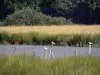
| Natural sites |
|---|
| Last name | Activity type | Rate | City |
|---|---|---|---|
 | Entertainment | 12 € to 19 € | Écueillé (49 km) |
| Last name | Outing type | Difficulty | Duration | Departure municipality |
|---|---|---|---|---|
 | Car itinerary | Easy | 45 min | Saint-Sébastien (29 km) |
 | Hike | Easy | 2:30 | Thollet (31 km) |
 | Hike | Intermediate | 1:45 | La Trimouille (32 km) |
 | Car itinerary | Easy | 1:00 | La Trimouille (32 km) |
 | Car itinerary | Easy | 1:00 | La Trimouille (33 km) |