
Favourite
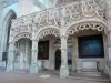
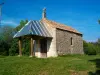
The Saint-Hymetière church


| Municipality | Salavre |
|---|---|
| Postcode | 01270 |
| Tourism label | ") |
| Latitude | 46.3640050 (N 46° 21’ 50”) |
| Longitude | 5.3466030 (E 5° 20’ 48”) |
| Altitude | From 203m to 561m |
| Surface area | 7.77 km² |
| Population | 281 inhabitants |
| Density | 36 inhabitants/km² |
| Prefecture | Bourg-en-Bresse (23 km, 27 min) |
| Insee code | 01391 |
| Intercommunality | CA du Bassin de Bourg-en-Bresse |
| Department | Ain |
| Territories | Alps, Jura mountains |
| Region | Auvergne-Rhône-Alps |
| Verjon | 2.2 km (5 min) |
|---|---|
| Coligny | 2.3 km (3 min) |
| Villemotier | 3.4 km (5 min) |
| Courmangoux | 5.2 km (10 min) |
| Pirajoux | 6.5 km (10 min) |
| Les Trois-Châteaux | 7.5 km (9 min) |
| Saint-Amour | 8.6 km (11 min) |
| Bény | 8.9 km (12 min) |
| Domsure | 9.2 km (13 min) |
| Val-d'Épy | 9.5 km (15 min) |
| Beaupont | 10.4 km (13 min) |
| Marboz | 10.4 km (15 min) |
| Saint-Étienne-du-Bois | 10.5 km (12 min) |
| Thoissia | 12 km (17 min) |
| Andelot-Morval | 13.4 km (22 min) |


| Last name | Activity type | Rate | City |
|---|---|---|---|
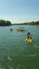
 | Sports sensations | 37 € | Joudes (11.1 km) |
 | Sports sensations | 45 € to 55 € | Clairvaux-les-Lacs (39 km) |
 | Sports sensations | 9 € to 20 € | Tournus (40 km) |
 | Sports sensations | 45 € | Saint-Claude (40 km) |
 | Sports sensations | 40 € to 65 € | Saint-Claude (40 km) |
| Last name | Outing type | Difficulty | Duration | Departure municipality |
|---|---|---|---|---|
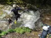
 | Hike | Easy | 40 min | Matafelon-Granges (19 km) |
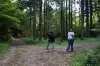
 | Hike | Easy | 2:30 | Gizia (19.1 km) |
 | Hike | Intermediate | 4:15 | Matafelon-Granges (20 km) |
 | Hike | Intermediate | 2:25 | Samognat (21 km) |
 | Hike | Intermediate | 4:45 | Bolozon (22 km) |