
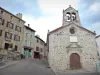

Favourite
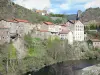
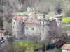
The Allier Gorges


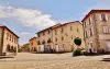


| Municipality | Siaugues-Sainte-Marie |
|---|---|
| Postcode | 43300 |
| Tourism label | ") |
| Latitude | 45.0947222 (N 45° 5’ 41”) |
| Longitude | 3.6333333 (E 3° 37’ 60”) |
| Altitude | From 540m to 1301m |
| Surface area | 40.01 km² |
| Population | 819 inhabitants |
| Density | 20 inhabitants/km² |
| Prefecture | Le Puy-en-Velay (26 km, 27 min) |
| Insee code | 43239 |
| Intercommunality | CC des Rives du Haut Allier |
| Department | Haute-Loire |
| Territories | Auvergne, Massif Central |
| Region | Auvergne-Rhône-Alps |
| Vissac-Auteyrac | 4.8 km (8 min) |
|---|---|
| Sainte-Eugénie-de-Villeneuve | 7.1 km (12 min) |
| Saint-Jean-de-Nay | 7.9 km (12 min) |
| Saint-Arcons-d'Allier | 9.4 km (15 min) |
| Vazeilles-Limandre | 10.3 km (13 min) |
| Saint-Bérain | 10.9 km (17 min) |
| Chanteuges | 11.1 km (16 min) |
| Le Vernet | 12 km (16 min) |
| Fix-Saint-Geneys | 12.1 km (15 min) |
| Jax | 12.2 km (19 min) |
| Chaspuzac | 12.7 km (18 min) |
| Saint-Julien-des-Chazes | 13 km (20 min) |
| Vernassal | 13.3 km (20 min) |
| Loudes | 13.4 km (20 min) |
| Vergezac | 13.8 km (19 min) |
| Information points |
|---|

| Last name | Activity type | Rate | City |
|---|---|---|---|
 | Sports sensations | 50 € to 60 € | Vieille-Brioude (27 km) |
| Last name | Outing type | Difficulty | Duration | Departure municipality |
|---|---|---|---|---|
 | Hike | Intermediate | 1:40 | Allègre (13.3 km) |
 | Hike | Easy | 25 min | Aiguilhe (20 km) |
 | Hike | Easy | 1:30 | Lavoûte-sur-Loire (22 km) |
 | Hike | Intermediate | 4:00 | Cayres (23 km) |
 | Hike | Easy | 2:30 | Cayres (23 km) |