

Favourite
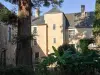
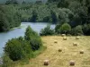
The Sarthe Valley
| Municipality | Tassé |
|---|---|
| Postcode | 72430 |
| Tourism label | ") |
| Latitude | 47.8899400 (N 47° 53’ 24”) |
| Longitude | -0.1348000 (W 0° 8’ 5”) |
| Altitude | From 32m to 87m |
| Surface area | 10.77 km² |
| Population | 302 inhabitants |
| Density | 28 inhabitants/km² |
| Prefecture | Le Mans (35 km, 41 min) |
| Insee code | 72347 |
| Intercommunality | CC LBN Communauté |
| Department | Sarthe |
| Territory | Maine |
| Region | Pays de la Loire |
| Pirmil | 3.9 km (7 min) |
|---|---|
| Noyen-sur-Sarthe | 3.9 km (7 min) |
| Chantenay-Villedieu | 4.5 km (7 min) |
| Avoise | 7.1 km (10 min) |
| Saint-Pierre-des-Bois | 7.3 km (11 min) |
| Saint-Jean-du-Bois | 8.8 km (12 min) |
| Maigné | 9.2 km (13 min) |
| Fontenay-sur-Vègre | 9.2 km (12 min) |
| Saint-Ouen-en-Champagne | 9.9 km (13 min) |
| Saint-Christophe-en-Champagne | 10.2 km (15 min) |
| Chevillé | 10.2 km (11 min) |
| Fercé-sur-Sarthe | 10.6 km (12 min) |
| Vallon-sur-Gée | 10.6 km (17 min) |
| Asnières-sur-Vègre | 10.9 km (12 min) |
| Poillé-sur-Vègre | 12.5 km (15 min) |
| Last name | Activity type | Rate | City |
|---|---|---|---|
 | Entertainment | 26 € | La Flèche (25 km) |
| Last name | Outing type | Difficulty | Duration | Departure municipality |
|---|---|---|---|---|
 | Hike | Easy | 3:00 | Saint-Denis-d'Anjou (25 km) |
 | Hike | Easy | 20 min | Durtal (26 km) |
 | Hike | Intermediate | 3:00 | Les Hauts-d'Anjou (32 km) |
| Hike | Easy | 3:30 | Coulongé (34 km) |
 | Village visit | Easy | 1:15 | Mayet (34 km) |