Follow the path "Le Bourg" and join the road. On your right, head for the "Lakes Road". Arrived at a crossroads in the shape of a triangle (terre-plein de verdure), take the first on your right "Chemin des Carrières". You will then follow the old gravel pit "Les Lacs". When you have finished along the lakes, pass the few houses that will be on your right and take this path "La Piguille". Continue this way to the end and then take the "Hurley Road" on the right. A few meters further on your left, take the white path that will take you right to the "Route de Caillon" and turn left. Then take the next road to the right on "Chemin de Chassaigne". Turn on the first road on the left then follow the signs leading into the vineyards. Attention, you will arrive at the level of the RN 137 at the end of your journey in the vineyards. Then go to the left and keep your left for your safety. A few meters away, take the "Chemin Pierre Levreaud" and admire the chapel of the Templars of Saint-Laurent d'Arce. Then, retrace your steps and cross the RN 137. Take "Rue de Magrigne". Continue straight ahead and turn on the dirt road that will be on your right at the entrance to the forest. Follow the beacons that will lead you to the "Rue de Canteloudette". Continue on this street then turn right and follow the beacons through the forest. Take a few meters on the D 142 and turn right again on a new dirt road where you will join the "Chemin des Prévots". At the end of this path, turn right on "Route de Puymorin". Be careful, you arrive at a roundabout with heavy traffic. Cross it then take "Route de Cablanc" direction Saint-Laurent d'Arce. Continue your way to the third intersection on your left on "Rue du Lavoir". Take the first street on the right then, a few steps and you have arrived.

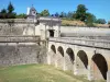
Bourg