This circuit will allow you to discover the Roche du Feu, the highest point of the Black Mountains (281 meters) and its exceptional 360 ° panorama.
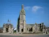
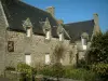
The parish closes


This circuit will allow you to discover the Roche du Feu, the highest point of the Black Mountains (281 meters) and its exceptional 360 ° panorama.
| Department | Finistère |
|---|---|
| Departure municipality | Gouézec |
| Outing type | Hike |
| Difficulty | Intermediate |
| Duration | 3:35 |
| Recommended period | from january to december |
| Kilometres | 10 km |
| Altitude upon departure | 113m |
| Change in altitude | 150m |
Departure: Chapelle des Trois Fontaines on the edge of the D785 leading to Pleyben.
Departure: Chapelle des Trois Fontaines on the edge of the D785 leading to Pleyben.
(D / A) Take the small road, leaving the chapel and its mutilated ordeal on the left.
(1) At the crow's feet (cross), follow the road going up to the right towards Kernevez, Kerlann, Ty Ridou. Continue this road, pass Kerzerrien and Pennaguer. On your left you see the summit of Karreg an Tan.
(2) After Kerarmet, meeting the road coming from Edern, turn left. At a cross, turn left to reach the car park, the starting point of the climb.
(3) Begin the climb by the well-marked path. The climb is relatively short. There are stairs a little before the summit. Up there, a vast panorama over the Châteaulin basin and the Monts d'Arrée to the north.
(4) The descent is made by following a small path marked in places by yellow and orange markers. The circuit is not always easy because many variations exist used by mountain bikes. As a priority, keep the path that goes to the left and goes around a coniferous wood.
Turn left at 90 °, pass between two coniferous woods and turn right to descend straight on a small road.
(6) Turn left and follow this road which leads to the starting point, passing through Ménez Crenn, Baradozic.
Go back to (1) and join the chapel (D / A).
Waypoints:
D / A: km 0 - alt. 113 m - Chapel of the Three Fountains.
1: km 0.47 - alt. 147 m - Crow's feet.
2: km 4.06 - alt. 209 m - Turn left.
3: km 4.62 - alt. 209 m - Ascent path to the Roche du Feu.
4: km 5.14 - alt. 263 m - Summit.
5: km 5.93 - alt. 208 m - Left at 90 ° between two softwood lumber.
6: km 6.48 - alt. 170 m - To the left for the return by the small road.
D / A: km 9.71 - alt. 113 m - Chapel of the Three Fountains.
Practical information: NB: Circuit mainly taking small roads offering views of the Châteaulin Basin. In winter, the final climb as well as the descent can be slippery. Always be careful and foresight when hiking.