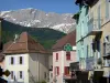
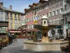
In the heart of the Champsaur valley, a discovery trail accessible to all users: walkers, horse riders, cyclists. Signposted with interpretation boards.
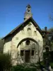
Discover the antique "Roman Way", the abandoned railway line project between Corps and Gap, and the heritage sites showing how water was managed and supplied (aqueducts, canals, etc.).