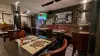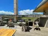


Favourite
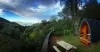
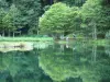
Bethmale lake
| Municipality | Antras |
|---|---|
| Postcode | 09800 |
| Latitude | 42.8810530 (N 42° 52’ 52”) |
| Longitude | 0.9431880 (E 0° 56’ 35”) |
| Altitude | From 777m to 2268m |
| Surface area | 20.02 km² |
| Population | 75 inhabitants |
| Density | 3 inhabitants/km² |
| Prefecture | Foix (70 km, 1:16) |
| Insee code | 09011 |
| Intercommunality | CC Couserans-Pyrénées |
| Department | Ariège |
| Territories | Midi-Pyrénées, Pyrenees |
| Region | Occitanie |
| Sentein | 2.2 km (5 min) |
|---|---|
| Bonac-Irazein | 4.1 km (9 min) |
| Balacet | 7.3 km (14 min) |
| Bordes-Uchentein | 10.5 km (16 min) |
| Arrien-en-Bethmale | 12.7 km (21 min) |
| Castillon-en-Couserans | 12.9 km (21 min) |
| Audressein | 14.2 km (23 min) |
| Cescau | 14.5 km (25 min) |
| Salsein | 15 km (23 min) |
| Bethmale | 15.6 km (27 min) |
| Sor | 16.2 km (26 min) |
| Arrout | 16.5 km (27 min) |
| Argein | 16.8 km (25 min) |
| Engomer | 17.7 km (26 min) |
| Last name | Activity type | Rate | City |
|---|---|---|---|
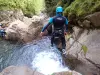 | Sports sensations | 35 € to 60 € | Bagnères-de-Luchon (30 km) |
 | Nature and the great outdoors | 29 € to 65 € | Arreau (48 km) |
| Last name | Outing type | Difficulty | Duration | Departure municipality |
|---|---|---|---|---|
 | Village visit | Easy | 4:00 | Galey (6.5 km) |
 | Hike | Easy | 4:00 | La Bastide-de-Sérou (42 km) |
 | Hike | Intermediate | 3:00 | Bize (42 km) |
 | Cycling itinerary | Athletic | 5:45 | Arreau (48 km) |
 | Hike | Easy | 4:00 | Sailhan (50 km) |