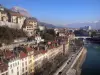
Claix is a town in Isère, in the Auvergne-Rhône-Alpes region, 10 km southwest of Grenoble.
Ranging from 226 to 1960 m above sea level, its territory of 24 km² is bordered to the east by the course of the Drac and to the west, it already belongs to the Vercors massif. As such, the locality has both the characteristics of a mountain town and that of a town that has become one of the urban entities of the Grenoble area... As a result, forests, meadows and agricultural land cover 80% of the area of Claix.
Already occupied during Prehistory and then in Antiquity, it was in the Middle Ages that the parish developed and the seigneury of Claix, which belonged in the 15th century to a comrade in arms of Joan of Arc, benefited from the the beginning of the 17th century of the dynamism of Lesdiguières, which held all the Dauphiné: a first bridge over the Drac was then built (1611).
The following century saw Claix specialize in silkworm culture and in the 19th century, industries were established. Two main districts are formed: the historic village and, in the Drac plain, the Pont Rouge. While the town was dismembered in 1873 when Pont-de-Claix acquired its autonomy, in the twentieth century, the city gained in population but preserved its environment, with its hamlets spanning the foothills of the Vercors.
Today, Claix has a population of around 8,200. Its rich historical heritage and its mountain landscapes make it a green lung of the agglomeration where leisure activities are numerous.
Via signs and plaques but also a walking path dedicated to its history (inquire at +33 4 76 98 15 36), the town of Claix highlights its historical heritage.
The Fort de Comboire, built in the 1880s to protect access to Grenoble, is thus to be discovered. Appearing in the form of an elongated building with arcades on two levels, partly covered with earth, the fort was occupied by the army until 1970 but did not however play a notable military role.
Next, see the Pont de Lesdiguières sur le Drac (17th century), which now separates the town of Pont-de-Claix. The audacity of its architecture (a single arch of 46 m) justified its inclusion in the Inventory. The structure (which a more recent bridge doubles) is highlighted by night lighting. We will also observe the old doors of the bridge and the room of the guards where the legend says that the famous brigand Mandrin would have taken refuge.
The ruins of the delphinal castle (12th century), namely elements of the keep, the chapel and the surrounding wall, the old fortified house of the Grange aux Dames (15th century) with its mullioned windows, and the Saint-Pierre church (1827) are still on the route. The latter notably houses an 18th century Christ on the Cross, a reliquary of the True Cross and an astonishing collection of copes and chasubles.
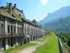
The house of Mariette d'Enghien (15th century), with its tower and its Gothic windows, the Place des Alpes bordered by dwellings dating from before the Revolution and the Tour des Alpes in the shape of a belfry, then the bandstand of the interwar period complete this tour of the city.
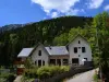
But the many hamlets also retain a rich heritage. This is the case of the castle of Montolivet mentioned in the thirteenth century which was succeeded in 1901 by a manor of Germanic inspiration, of the castle of la Ronzy (seventeenth, remodeled in the nineteenth), looking like a Tuscan residence, of the castle of Furonnière (18th, 19th) or even the Maison des Champs which belonged to Stendhal's father.
Sur Cossey, the oldest of the hamlets in the town of Claix, have been preserved the Saint-Jean chapel, attested from the 11th century and which has preserved a Gothic choir with recently restored 17th century paintings, a holy water font from the 15th century, but also 16th century dwellings, a fountain from the same period… not to mention a 17th century castle built on the foundations of a fortified house.
Finally, on La Balme, the possession of the bishops of Grenoble until the Revolution, the castle rebuilt in the 17th century with its magnificent path lined with centuries-old chestnut and lime trees has retained all of its charm.
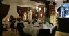
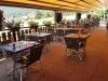
On the cultural side, the Déclic auditorium hosts concerts and plays in an intimate setting (information on +33 4 76 98 45 73) and the Brassens media library programs activities (readings, exhibitions, meetings) throughout the year (contact on +33 4 76 98 49 27).
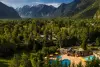
For athletes, the Pompidou area includes a football field, a beach volleyball court and a relaxation area, and the Bâtie area has a fitness trail, a skate park, '' a synthetic football pitch, tennis courts and other free access equipment (inquire at +33 4 76 99 45 73).
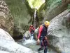
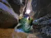
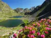
For hikers, from the banks of the Drac to the foothills of the Vercors, passing through still preserved pastures and a peat bog protected as natural areas, the town has great potential. From urbanized areas to the first summits of Vercors, six marked trails have been traced, or 30 km of route! Of course, longer loops can also allow you to reach Grenoble. Maps and information on +33 4 76 98 15 36 or +33 4 76 42 41 41.
We won't forget the activities, thematic hikes and workshops organized by the Vercors Regional Natural Park: information on +33 4 76 94 38 26.
")