


Favourite
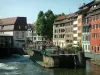
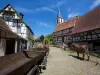
Strasbourg
| Municipality | Kilstett |
|---|---|
| Postcode | 67840 |
| Tourism label | ") |
| Latitude | 48.6749340 (N 48° 40’ 30”) |
| Longitude | 7.8577240 (E 7° 51’ 28”) |
| Altitude | From 126m to 131m |
| Surface area | 6.90 km² |
| Population | 2539 inhabitants |
| Density | 367 inhabitants/km² |
| Prefecture | Strasbourg (22 km, 22 min) |
| Insee code | 67237 |
| Intercommunality | CC du Pays Rhénan |
| Department | Bas-Rhin |
| Territory | Alsace |
| Region | Great East |
| Gambsheim | 3.9 km (6 min) |
|---|---|
| La Wantzenau | 4.2 km (8 min) |
| Offendorf | 6.3 km (11 min) |
| Hoerdt | 7.6 km (9 min) |
| Herrlisheim | 7.7 km (11 min) |
| Reichstett | 10 km (12 min) |
| Hoenheim | 10.5 km (14 min) |
| Weyersheim | 10.7 km (15 min) |
| Bischheim | 11.3 km (16 min) |
| Souffelweyersheim | 11.7 km (17 min) |
| Bietlenheim | 11.8 km (15 min) |
| Geudertheim | 11.8 km (16 min) |
| Rohrwiller | 11.9 km (18 min) |
| Vendenheim | 12.6 km (16 min) |
| Kurtzenhouse | 13.2 km (17 min) |
| Transport |
|---|
| Last name | Activity type | Rate | City |
|---|---|---|---|
 | Arts and Crafts | 50 € | Hoerdt (5.9 km) |
 | Entertainment | 24 € | Strasbourg (12.5 km) |
 | Culture and education | 4 € to 6 € | Kutzenhausen (29 km) |
 | Sports sensations | 25 € to 80 € | Niederbronn-les-Bains (34 km) |
| Last name | Outing type | Difficulty | Duration | Departure municipality |
|---|---|---|---|---|
 | Hike | Easy | 1:30 | Schiltigheim (11 km) |
 | Mountain bike itinerary | Easy | 20 min | Soufflenheim (18.7 km) |
 | Cycling itinerary | Easy | 3:00 | Osthoffen (24 km) |
 | Hike | Easy | 1:00 | Kuttolsheim (25 km) |
| Hike | Easy | 2:00 | Hatten (27 km) |