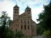
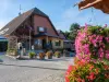
Mitzach is an Alsatian village, whose inhabitants are called Mitzachois and Mitzachoises.
Joint Regional Natural Park of Ballons des Vosges, Mitzach the canton of Saint-Amarin and the district of Thann.
Its main river is the Rhine.


Mitzach is an Alsatian village, whose inhabitants are called Mitzachois and Mitzachoises.
Joint Regional Natural Park of Ballons des Vosges, Mitzach the canton of Saint-Amarin and the district of Thann.
Its main river is the Rhine.
| Municipality | Mitzach |
|---|---|
| Postcode | 68470 |
| Latitude | 47.8711500 (N 47° 52’ 16”) |
| Longitude | 7.0047570 (E 7° 0’ 17”) |
| Altitude | From 410m to 1050m |
| Surface area | 6.41 km² |
| Population | 392 inhabitants |
| Density | 61 inhabitants/km² |
| Prefecture | Colmar (57 km, 57 min) |
| Insee code | 68211 |
| Intercommunality | CC de la Vallée de Saint-Amarin |
| Department | Haut-Rhin |
| Territory | Alsace |
| Region | Great East |
| Ranspach | 2.2 km (6 min) |
|---|---|
| Saint-Amarin | 2.5 km (6 min) |
| Husseren-Wesserling | 3.1 km (8 min) |
| Malmerspach | 3.9 km (6 min) |
| Fellering | 4 km (8 min) |
| Moosch | 4.5 km (6 min) |
| Mollau | 5.8 km (11 min) |
| Oderen | 6 km (10 min) |
| Urbès | 6.2 km (9 min) |
| Storckensohn | 6.7 km (11 min) |
| Willer-sur-Thur | 7.1 km (9 min) |
| Geishouse | 7.5 km (13 min) |
| Kruth | 8.6 km (13 min) |
| Bitschwiller-lès-Thann | 9.6 km (13 min) |
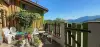
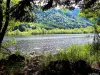
See the Stoerenburg pond.
Discover the summit of the Stoerenburg hill, an admirable belvedere over Saint-Amarin and the valley. There was the Stoerenburg castle there, of which nothing remains.
Starting point for many hiking trails. To do, the path of the poets.


| Last name | Activity type | Rate | City |
|---|---|---|---|
 | Culture and education | 11 € | Le Thillot (18.1 km) |
 | Arts and Crafts | 12 € | Basse-sur-le-Rupt (23 km) |
 | Entertainment | Free | Xonrupt-Longemer (25 km) |
 | Culture and education | 6 € to 8 € | Labaroche (29 km) |
 | Culture and education | 12 € | Laveline-devant-Bruyères (39 km) |
| Last name | Outing type | Difficulty | Duration | Departure municipality |
|---|---|---|---|---|
 | Hike | Intermediate | 3:00 | Ranspach (1.7 km) |
 | Hike | Intermediate | 4:40 | Rimbach-près-Masevaux (6.5 km) |
 | Hike | Intermediate | 2:30 | Kirchberg (8.8 km) |
 | Hike | Intermediate | 1:05 | Thann (10 km) |
 | Hike | Easy | 1:00 | Sewen (10.2 km) |