


Favourite
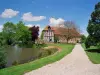
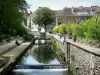
Conches-en-Ouche
| Municipality | Sainte-Marthe |
|---|---|
| Postcode | 27190 |
| Tourism label | ") |
| Latitude | 48.9691630 (N 48° 58’ 9”) |
| Longitude | 0.8796270 (E 0° 52’ 47”) |
| Altitude | From 125m to 182m |
| Surface area | 17.50 km² |
| Population | 504 inhabitants |
| Density | 28 inhabitants/km² |
| Prefecture | Evreux (24 km, 31 min) |
| Insee code | 27568 |
| Intercommunality | CC du Pays de Conches |
| Department | Eure |
| Region | Normandy |
| Tilleul-Dame-Agnès | 4.2 km (10 min) |
|---|---|
| Sébécourt | 4.6 km (6 min) |
| Le Fidelaire | 6.7 km (9 min) |
| Collandres-Quincarnon | 7.2 km (9 min) |
| Conches-en-Ouche | 7.3 km (9 min) |
| Burey | 8.1 km (11 min) |
| La Ferrière-sur-Risle | 8.4 km (10 min) |
| Louversey | 8.5 km (9 min) |
| Romilly-la-Puthenaye | 9.1 km (13 min) |
| Nagel-Séez-Mesnil | 9.3 km (10 min) |
| Saint-Élier | 9.5 km (14 min) |
| La Houssaye | 10.1 km (12 min) |
| Faverolles-la-Campagne | 11.2 km (12 min) |
| Le Lesme | 11.5 km (17 min) |
| Natural sites |
|---|
| Last name | Outing type | Difficulty | Duration | Departure municipality |
|---|---|---|---|---|
 | Hike | Easy | 2:50 | Mouettes (36 km) |
 | Cycling itinerary | Easy | 4:00 | Montfort-sur-Risle (39 km) |
 | All-terrain bike itinerary | Easy | 55 min | Neuilly (41 km) |
 | Hike | Intermediate | 1:10 | Orival (41 km) |
 | Hike | Easy | 35 min | Orival (41 km) |