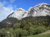
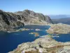
This mountain hike will allow you to discover beautiful landscapes dotted with ten lakes of all sizes, in the middle of pastures and scree.
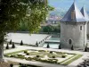
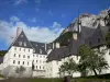
Château du Touvet
This mountain hike will allow you to discover beautiful landscapes dotted with ten lakes of all sizes, in the middle of pastures and scree.

| Department | Isère |
|---|---|
| Departure municipality | Le Haut-Bréda |
| Outing type | Hike |
| Difficulty | Athletic |
| Duration | 6:00 |
| Recommended period | from june to september |
| Kilometres | 16 km |
| Altitude upon departure | 1068m |
| Change in altitude | 1100m |
Departure from Fond de France (D281) which is reached by Allevard, Pinsot (D525a) then by the road leading to the Pleynet station. Parking in front of the former hotel des 7 Laux.
Map IGN 3335 AND The Bourg d'Oisans - Alpe d'Huez - Seven Laux.
From the car park, take the S-shaped path behind the hotel, climb into the woods, cross the Pleynet stream before crossing a coniferous forest.
At the locality Les 2 riveaux, signs indicate two access routes to the plateau. You can book for the descent the path on the right passing through the cottage Gleyzin (harder to climb) to borrow the Two Creek on the left.
You will reach a mineral valley under the ridge of Mouchillon, then after steep laces, the remains of the cottage of Two Brooks located at 1,990 m altitude.
You will then head to the Col de la Vieille, marking the finish on the plateau before the junction with the trail passing through the Gleyzin chalet.
Black Lake is at the rear of a rock lock dominated by an EDF pylon.
Continue to climb under the cables of the EDF freight elevator, then leave to the right the buildings of the installations to join the lakes Carré, Cottepens and La Motte, as well as the shelter of the Seven Laux built at 2 135 meters of altitude, on a rocky island between Lake Carré and Lake Cottepens.
For the return, you will take the path passing by the chalet of Gleyzin.