Favourite
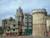
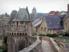
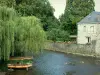
Vitré
| Municipality | Balazé |
|---|---|
| Postcode | 35500 |
| Tourism label | ") |
| Latitude | 48.1681100 (N 48° 10’ 5”) |
| Longitude | -1.1931190 (W 1° 11’ 35”) |
| Altitude | From 70m to 169m |
| Surface area | 36.66 km² |
| Population | 2272 inhabitants |
| Density | 61 inhabitants/km² |
| Prefecture | Rennes (48 km, 44 min) |
| Insee code | 35015 |
| Intercommunality | CA Vitré Communauté |
| Department | Ille-et-Vilaine |
| Region | Brittany |
| Taillis | 4.6 km (9 min) |
|---|---|
| Vitré | 6.1 km (10 min) |
| Saint-M'Hervé | 6.4 km (12 min) |
| Châtillon-en-Vendelais | 7.1 km (9 min) |
| Montreuil-sous-Pérouse | 7.6 km (10 min) |
| Saint-Christophe-des-Bois | 9.1 km (13 min) |
| Pocé-les-Bois | 9.2 km (12 min) |
| Montautour | 9.3 km (12 min) |
| Landavran | 11.5 km (15 min) |
| La Croixille | 11.7 km (16 min) |
| Bourgon | 12.1 km (19 min) |
| Montreuil-des-Landes | 12.3 km (16 min) |
| Champeaux | 12.7 km (15 min) |
| Val-d'Izé | 13.3 km (14 min) |
| Last name | Outing type | Difficulty | Duration | Departure municipality |
|---|---|---|---|---|
 | Hike | Intermediate | 2:10 | La Bouëxière (18.2 km) |
 | Hike | Intermediate | 3:00 | Piré-Chancé (25 km) |
 | Hike | Intermediate | 2:00 | Ercé-près-Liffré (26 km) |
 | Hike | Intermediate | 2:45 | Châteaugiron (26 km) |
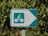 | All-terrain bike itinerary | Intermediate | 2:05 | Châteaugiron (26 km) |