

Favourite
The Nantes to Brest canal
| Municipality | Cléden-Poher |
|---|---|
| Postcode | 29270 |
| Tourism label | ") |
| Latitude | 48.2353310 (N 48° 14’ 7”) |
| Longitude | -3.6685980 (W 3° 40’ 7”) |
| Altitude | From 53m to 155m |
| Surface area | 29.81 km² |
| Population | 1155 inhabitants |
| Density | 38 inhabitants/km² |
| Prefecture | Quimper (59 km, 49 min) |
| Insee code | 29029 |
| Intercommunality | CC Poher communauté |
| Department | Finistère |
| Region | Brittany |
| Saint-Hernin | 4.4 km (6 min) |
|---|---|
| Landeleau | 6.3 km (9 min) |
| Kergloff | 7.1 km (9 min) |
| Spézet | 8 km (12 min) |
| Carhaix-Plouguer | 10.3 km (13 min) |
| Motreff | 13 km (18 min) |
| Collorec | 13.2 km (20 min) |
| Plounévézel | 13.5 km (16 min) |
| Châteauneuf-du-Faou | 14.4 km (15 min) |
| Saint-Goazec | 14.6 km (20 min) |
| Le Moustoir | 14.6 km (13 min) |
| Plouyé | 15 km (21 min) |
| Treffrin | 16.5 km (15 min) |
| Gourin | 16.9 km (19 min) |
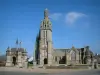
| Monuments |
|---|
| Last name | Outing type | Difficulty | Duration | Departure municipality |
|---|---|---|---|---|
 | Hike | Intermediate | 3:55 | Gourin (11 km) |
 | All-terrain bike itinerary | Athletic | 3:25 | Gourin (11.6 km) |
 | Hike | Easy | 1:15 | Le Saint (18 km) |
 | Hike | Intermediate | 3:20 | Berrien (19.7 km) |
 | Hike | Easy | 1:00 | Locarn (20 km) |