


Favourite
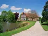
Conches-en-Ouche
| Municipality | Le Fidelaire |
|---|---|
| Postcode | 27190 |
| Tourism label | ") |
| Latitude | 48.9489260 (N 48° 56’ 56”) |
| Longitude | 0.8152920 (E 0° 48’ 55”) |
| Altitude | From 150m to 190m |
| Surface area | 33.55 km² |
| Population | 1023 inhabitants |
| Density | 30 inhabitants/km² |
| Prefecture | Evreux (30 km, 33 min) |
| Insee code | 27242 |
| Intercommunality | CC du Pays de Conches |
| Department | Eure |
| Region | Normandy |
| Sébécourt | 3.3 km (6 min) |
|---|---|
| La Ferrière-sur-Risle | 4.4 km (7 min) |
| Collandres-Quincarnon | 5.9 km (10 min) |
| Sainte-Marthe | 6.7 km (9 min) |
| La Vieille-Lyre | 6.8 km (8 min) |
| Le Lesme | 6.9 km (11 min) |
| La Houssaye | 6.9 km (11 min) |
| La Neuve-Lyre | 7.4 km (9 min) |
| Romilly-la-Puthenaye | 7.7 km (13 min) |
| Les Baux-de-Breteuil | 8.6 km (15 min) |
| Le Noyer-en-Ouche | 8.8 km (13 min) |
| Tilleul-Dame-Agnès | 10.5 km (16 min) |
| Bois-Normand-près-Lyre | 11.4 km (13 min) |
| Conches-en-Ouche | 11.4 km (14 min) |
| Last name | Activity type | Rate | City |
|---|---|---|---|
 | Local flavours | 55 € | Saint-Philbert-des-Champs (49 km) |
| Last name | Outing type | Difficulty | Duration | Departure municipality |
|---|---|---|---|---|
 | Cycling itinerary | Easy | 4:00 | Montfort-sur-Risle (40 km) |
 | Hike | Easy | 2:50 | Mouettes (40 km) |
 | Hike | Easy | 3:00 | Asnières (40 km) |
 | Hike | Easy | 3:00 | Condé-sur-Risle (43 km) |
 | Hike | Intermediate | 1:10 | Orival (44 km) |