Repas du 14 Juillet
- On 14 july 2024
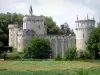
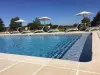
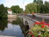
- Le Parc
- Come and enjoy a convivial moment at this country-style meal. Don't forget to reserve your place !
| Municipality | Lussac-les-Églises |
|---|---|
| Postcode | 87360 |
| Latitude | 46.3461510 (N 46° 20’ 46”) |
| Longitude | 1.1728190 (E 1° 10’ 22”) |
| Altitude | From 145m to 255m |
| Surface area | 41.02 km² |
| Population | 469 inhabitants |
| Density | 11 inhabitants/km² |
| Prefecture | Limoges (76 km, 55 min) |
| Insee code | 87087 |
| Intercommunality | CC Haut Limousin en Marche |
| Department | Haute-Vienne |
| Territory | Limousin |
| Region | New-Aquitaine |
| Verneuil-Moustiers | 3.8 km (4 min) |
|---|---|
| Saint-Martin-le-Mault | 4.3 km (7 min) |
| Bonneuil | 5.9 km (9 min) |
| Coulonges | 7.4 km (11 min) |
| Tersannes | 8.6 km (12 min) |
| Jouac | 11 km (12 min) |
| Tilly | 11 km (12 min) |
| Brigueil-le-Chantre | 11.3 km (12 min) |
| Saint-Léger-Magnazeix | 11.8 km (14 min) |
| Thollet | 11.8 km (16 min) |
| Azat-le-Ris | 12.3 km (12 min) |
| Mailhac-sur-Benaize | 13.2 km (11 min) |
| Beaulieu | 13.3 km (20 min) |
| Saint-Georges-les-Landes | 15.3 km (13 min) |

| Last name | Outing type | Difficulty | Duration | Departure municipality |
|---|---|---|---|---|
 | Hike | Easy | 2:30 | Thollet (10.8 km) |
 | Car itinerary | Easy | 1:00 | La Trimouille (16.8 km) |
 | Car itinerary | Easy | 1:00 | La Trimouille (16.8 km) |
 | Hike | Intermediate | 1:45 | La Trimouille (16.8 km) |
 | Hike | Easy | 3:35 | Lathus-Saint-Rémy (22 km) |